|
search place name
|
||
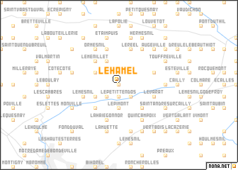
Le Hamel (Haute-Normandie, France)Le Hamel is a town in the Haute-Normandie region of France. An overview map of the region around Le Hamel is displayed below.
regional and 3d topo map of Le Hamel, France ::
Le Hamel airports ::
The nearest airport is URO - Rouen Vallee De Seine, located 22.2 km south of Le Hamel.
Other airports nearby include BVA - Beauvais Tille (71.2 km east), DOL - Deauville St Gatien (76.1 km west), LEH - Le Havre Octeville (77.0 km west), POX - Pontoise Cormeilles En Vexin (84.4 km south east), Nearby towns ::
Mont-Piel (0.0km north) //
Ratiéville (0.0km north) //
Le Petit-Tendos (1.9km south) //
Authieux-Ratiéville (1.9km north) //
Le Grand-Tendos (2.2km south west) //
Fontaine-le-Bourg (2.2km south east) //
Le Thil (2.2km north east) //
Le Pimont (3.7km south) //
Mont-Cauvaire (3.0km south west) //
Cléres (3.0km north west) //
Frichemesnil (3.9km north) //
Saint-Georges-sur-Fontaine (4.4km south east) //
Bosc-Guérard-Saint-Adrien (4.4km south west) //
Le Menillet (4.4km north west) //
Grugny (4.4km north west) //
Le Mesnil (4.1km south west) //
Le Varat (4.1km south east) //
Le Pière (5.7km north) //
La Haie-Gonnor (5.7km south) //
Le Réel (5.7km north) //
Claville-Motteville (4.1km north east) //
Ormesnil (6.1km north west) //
Quincampoix (6.1km south east) //
Bosc-le-Hard (6.1km north east) //
Saint-Germain-sous-Cailly (4.8km east) //
La Muette (7.5km south) //
Les Hauts Poiriers (7.5km south) //
Étaimpuis (7.5km north) //
Biennais (7.5km north) //
[all distances 'as the bird flies' and approximate] 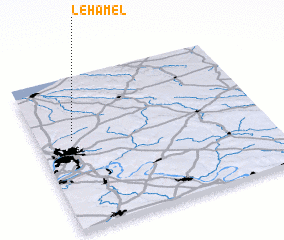 Places with similar names to Le Hamel, France ::
Disclaimer :: Information on this page comes without warranty of any kind |
||
|
Where is Le Hamel? Elevation and coordinates ::
Latitude (lat): 49°35'0"N Longitude (lon): 1°9'0"E
Elevation (approx.): 153m (map arrows pan, magnifying glasses zoom) |
||
|
Visiting Le Hamel? Hotel/Accommodation ::
Book a hotel in Le Hamel Travel Guide ::
Buy a travel guide for France rental cars ::
car rental offers GPS waypoint ::
download a GPX waypoint (PoI) of Le Hamel for your GPS receiver
|
||