|
search place name
|
||
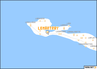
Le Martray (Poitou-Charentes, France)Le Martray is a town in the Poitou-Charentes region of France. An overview map of the region around Le Martray is displayed below.
regional and 3d topo map of Le Martray, France ::
Le Martray airports ::
The nearest airport is RCO - Rochefort St Agnant, located 52.4 km south east of Le Martray.
Other airports nearby include EDM - La Roche-sur-yon Les Ajoncs (56.1 km north), RYN - Royan Medis (75.3 km south east), NIT - Niort Souche (84.6 km east), NTE - Nantes Atlantique (106.1 km north), Nearby towns ::
Les Moulins de la Boire (2.2km west) //
Ars-en-Ré (2.7km north west) //
La Passe (2.8km east) //
Les Prises (3.3km east) //
Les Portes (5.3km north) //
La Rivière (5.7km north west) //
Lavaud (4.7km north east) //
Déramée (4.8km north east) //
Le Peux (5.0km north east) //
Saint-Clément-des-Baleines (5.9km north west) //
Le Gillieux (6.2km north west) //
Loix (6.4km north east) //
[all distances 'as the bird flies' and approximate] 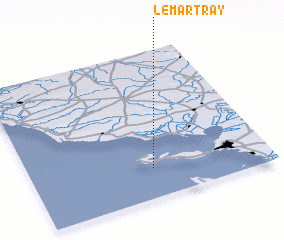 Places with similar names to Le Martray, France ::
// La Mortera (ES)
// La Mortera (ES)
// La Mortoria (CO)
// Lombardore (IT)
// La Martyre (FR)
// La Martre (FR)
// La Morterie (FR)
// Le Marteray (FR)
// Le Martroi (FR)
// Le Merdier (BE)
Disclaimer :: Information on this page comes without warranty of any kind |
||
|
Where is Le Martray? Elevation and coordinates ::
Latitude (lat): 46°12'10"N Longitude (lon): 1°29'15"W
Elevation (approx.): -1m (map arrows pan, magnifying glasses zoom) |
||
|
Visiting Le Martray? Hotel/Accommodation ::
Book a hotel in Le Martray Travel Guide ::
Buy a travel guide for France rental cars ::
car rental offers GPS waypoint ::
download a GPX waypoint (PoI) of Le Martray for your GPS receiver
|
||