|
search place name
|
||
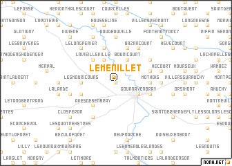
Le Menillet (Haute-Normandie, France)Le Menillet is a town in the Haute-Normandie region of France. An overview map of the region around Le Menillet is displayed below.
regional and 3d topo map of Le Menillet, France ::
Le Menillet airports ::
The nearest airport is BVA - Beauvais Tille, located 30.3 km east of Le Menillet.
Other airports nearby include URO - Rouen Vallee De Seine (40.2 km west), POX - Pontoise Cormeilles En Vexin (51.3 km south east), CSF - Creil (65.5 km south east), LBG - Paris Le Bourget (80.0 km south east), Nearby towns ::
Le Mesnil (0.0km north) //
Cuy-Saint-Fiacre (1.9km north) //
Le Mort (2.2km north west) //
Molagnies-Mannevieux (2.2km north east) //
Gournay-en-Bray (3.0km south east) //
Hyancourt (3.0km north east) //
Beuvreil (3.9km north) //
Bouricourt (3.9km north) //
Avesnes-en-Bray (4.4km south west) //
La Vieille Ville (4.4km north west) //
Dampierre (4.4km north west) //
Les Mouricours (3.6km west) //
Mothois (3.6km east) //
Heaumet (5.7km north) //
Gancourt-Saint-Étienne (5.7km north) //
Elbeuf-en-Bray (4.1km south west) //
Saint-Quentin-des-Prés (4.1km north east) //
Ferrières-en-Bray (4.1km south east) //
Bosc-Hyons (6.1km south west) //
Bazancourt (6.1km north east) //
Saint-Plantaire (6.1km south west) //
Beaulevrier (5.2km north east) //
Doudeauville (7.4km north) //
Laudancourt (4.8km east) //
Camp Caillot (5.2km west) //
Hécourt (5.2km east) //
Le Long Périer (6.6km north west) //
Ménerval (7.8km north) //
Clos Féron (7.4km south west) //
[all distances 'as the bird flies' and approximate]  Places with similar names to Le Menillet, France ::
// La Manuelita (CU)
// La Manuelita (CO)
// La Manuelita (CO)
// La Manuelita (CO)
// Le Menillet (FR)
// Le Ménilot (FR)
Disclaimer :: Information on this page comes without warranty of any kind |
||
|
Where is Le Menillet? Elevation and coordinates ::
Latitude (lat): 49°30'0"N Longitude (lon): 1°42'0"E
Elevation (approx.): 110m (map arrows pan, magnifying glasses zoom) |
||
|
Visiting Le Menillet? Hotel/Accommodation ::
Book a hotel in Le Menillet Travel Guide ::
Buy a travel guide for France rental cars ::
car rental offers GPS waypoint ::
download a GPX waypoint (PoI) of Le Menillet for your GPS receiver
|
||