|
search place name
|
||
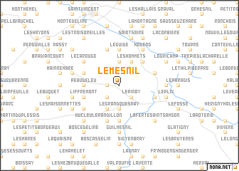
Le Mesnil (Haute-Normandie, France)Le Mesnil is a town in the Haute-Normandie region of France. An overview map of the region around Le Mesnil is displayed below.
regional and 3d topo map of Le Mesnil, France ::
Le Mesnil airports ::
The nearest airport is URO - Rouen Vallee De Seine, located 35.6 km south west of Le Mesnil.
Other airports nearby include BVA - Beauvais Tille (49.7 km south east), POX - Pontoise Cormeilles En Vexin (72.1 km south east), CSF - Creil (86.2 km south east), LTQ - Le Tourquet Le Touquet Paris Plage (98.8 km north), Nearby towns ::
La Cavée (1.2km west) //
Roncherolles-en-Bray (2.2km south west) //
LʼÉpinay (2.2km south east) //
Le Grand Quesnay (3.7km south) //
La Rosière (3.7km north) //
Mauquenchy (3.9km south) //
Les Hommets (3.9km north) //
Mesnil-Mauger (4.4km north east) //
La Chaule (5.6km south) //
Peaudeleu (3.6km west) //
Sommery (3.6km west) //
La Huchonne (5.6km north) //
Le Guide (5.6km north) //
Le Randillon (5.7km south) //
La Hêtrée (4.1km south east) //
Liffremont (4.1km south west) //
Dambec (5.7km north) //
Attevillette (4.0km north west) //
Sainte-Geneviève-en-Bray (4.0km north west) //
Beaubec-la-Rosière (4.0km north east) //
Forgettes (5.2km south west) //
Le Carouge (5.2km north west) //
Canchy (5.2km north west) //
Hodeng (6.1km north east) //
Rouvray-Catillon (7.4km south) //
Guilmesnil (7.4km south) //
Serqueux (4.8km east) //
Équinnemare (5.1km west) //
La Pommeraye (5.1km west) //
[all distances 'as the bird flies' and approximate]  Places with similar names to Le Mesnil, France ::
Disclaimer :: Information on this page comes without warranty of any kind |
||
|
Where is Le Mesnil? Elevation and coordinates ::
Latitude (lat): 49°38'0"N Longitude (lon): 1°29'0"E
Elevation (approx.): 142m (map arrows pan, magnifying glasses zoom) |
||
|
Visiting Le Mesnil? Hotel/Accommodation ::
Book a hotel in Le Mesnil Travel Guide ::
Buy a travel guide for France rental cars ::
car rental offers GPS waypoint ::
download a GPX waypoint (PoI) of Le Mesnil for your GPS receiver
|
||