|
search place name
|
||
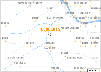
Léogeats (Aquitaine, France)Léogeats is a town in the Aquitaine region of France. An overview map of the region around Léogeats is displayed below.
regional and 3d topo map of Léogeats, France ::
Léogeats airports ::
The nearest airport is BOD - Bordeaux Merignac, located 44.3 km north west of Léogeats.
Other airports nearby include XAC - Arcachon La Teste De Buch (59.8 km west), EGC - Bergerac Roumaniere (78.1 km north east), AGF - Agen La Garenne (85.3 km south east), PGX - Perigueux Bassillac (120.3 km north east), Nearby towns ::
Bommes (1.9km north) //
Budos (2.3km north west) //
Noaillan (3.7km south) //
Sauternes (3.2km north east) //
Villandraut (5.6km south) //
Pujols-sur-Ciron (5.7km north) //
Fargues-de-Langon (5.6km east) //
Landiras (6.8km north west) //
Balizac (6.5km south west) //
Uzeste (8.4km south east) //
Preignac (9.1km north east) //
[all distances 'as the bird flies' and approximate] 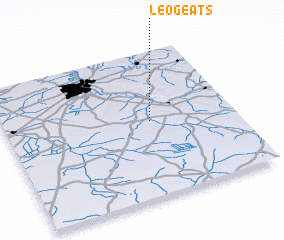 Places with similar names to Léogeats, France ::
Disclaimer :: Information on this page comes without warranty of any kind |
||
|
Where is Léogeats? Elevation and coordinates ::
Latitude (lat): 44°31'0"N Longitude (lon): 0°22'0"W
Elevation (approx.): 22m (map arrows pan, magnifying glasses zoom) |
||
|
Visiting Léogeats? Hotel/Accommodation ::
Book a hotel in Léogeats Travel Guide ::
Buy a travel guide for France rental cars ::
car rental offers GPS waypoint ::
download a GPX waypoint (PoI) of Léogeats for your GPS receiver
|
||