|
search place name
|
||
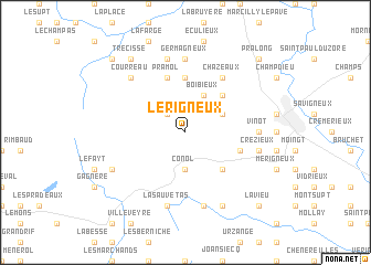
Lérigneux (Rhône-Alpes, France)Lérigneux is a town in the Rhône-Alpes region of France. An overview map of the region around Lérigneux is displayed below.
regional and 3d topo map of Lérigneux, France ::
Lérigneux airports ::
The nearest airport is EBU - St.-etienne Boutheon, located 26.6 km east of Lérigneux.
Other airports nearby include RNE - Roanne Renaison (51.0 km north), LPY - Le Puy Loudes (59.9 km south), XVF - Vilefrance Tarare (61.9 km north east), CFE - Clermont Ferrand Auvergne (65.5 km west), Nearby towns ::
Roche (2.3km north west) //
Conol (3.7km south) //
Boibieux (3.9km north) //
Essertines-en-Châtelneuf (3.2km north east) //
Châtelneuf (4.5km north east) //
Verrières-en-Forez (4.5km south east) //
Planchat (5.6km north) //
Pramol (5.7km north) //
Bucherolles (5.7km north) //
Bard (4.3km south east) //
Chazeaux (6.1km north east) //
Vinot (5.2km east) //
Germagneux (7.4km north) //
Crézieux (5.5km east) //
Gumières (7.5km south) //
Saint-Bonnet-le-Courreau (7.5km north) //
La Sauvetas (7.5km south) //
Courreau (6.8km north west) //
Chazelles-sur-Lavieu (7.9km south) //
Faye-Furet (6.4km south west) //
Trécisse (8.4km north west) //
Lavieu (9.0km south east) //
Pralong (9.0km north east) //
Sauvain (9.0km north west) //
[all distances 'as the bird flies' and approximate]  Places with similar names to Lérigneux, France :: Disclaimer :: Information on this page comes without warranty of any kind |
||
|
Where is Lérigneux? Elevation and coordinates ::
Latitude (lat): 45°36'0"N Longitude (lon): 3°58'0"E
Elevation (approx.): 901m (map arrows pan, magnifying glasses zoom) |
||
|
Visiting Lérigneux? Hotel/Accommodation ::
Book a hotel in Lérigneux Travel Guide ::
Buy a travel guide for France rental cars ::
car rental offers GPS waypoint ::
download a GPX waypoint (PoI) of Lérigneux for your GPS receiver
|
||