|
search place name
|
||
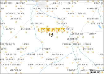
Les Bruyères (Centre, France)Les Bruyères is a town in the Centre region of France. An overview map of the region around Les Bruyères is displayed below.
regional and 3d topo map of Les Bruyères, France ::
Les Bruyères airports ::
The nearest airport is MCU - Montlucon Domerat, located 29.5 km south of Les Bruyères.
Other airports nearby include MCU - Montlucon-gueret Montlucon Gueret (45.7 km south), BOU - Bourges (50.6 km north), NVS - Nevers Fourchambault (61.6 km north east), CHR - Chateauroux Deols (67.1 km north west), Nearby towns ::
Chadet (1.3km east) //
Les Petits Fossés (2.2km north west) //
La Roche (2.2km north east) //
La Celette (3.9km north) //
Le Grand Bord (3.1km north west) //
Saulzais-le-Potier (3.1km south west) //
Buhard (3.1km north east) //
La Perche (4.5km north east) //
Les Rainats (4.2km north east) //
Les Rais (5.7km south) //
La Bouchatte (5.7km south) //
Ainay-le-Vieil (5.7km north) //
Montrevaux (5.3km north west) //
LʼÉtelon (5.3km north east) //
Meslon (6.1km north east) //
Channay (5.3km south east) //
Les Mamourets (5.3km south east) //
La Groutte (7.5km north) //
Urçay (5.4km east) //
Le Vernet (5.4km east) //
Les Gerpins (7.5km south) //
Faverdines (6.3km north west) //
Huffaut (6.3km north west) //
Poisieux (7.8km north) //
Vernet (7.8km south) //
Saint-Georges-de-Poisieux (8.3km north west) //
Épineuil-le-Fleuriel (8.3km south east) //
Changy (9.0km north east) //
Vallant (9.0km south west) //
[all distances 'as the bird flies' and approximate]  Places with similar names to Les Bruyères, France ::
// Les Bruyères (FR)
// Les Bruyères (FR)
// Les Bruyères (FR)
// Les Bruyères (FR)
// Les Bruyères (FR)
// Les Bruyères (FR)
// Les Bruyères (FR)
// Les Bruyères (FR)
// Les Bruyères (FR)
// Les Bruyères (FR)
Disclaimer :: Information on this page comes without warranty of any kind |
||
|
Where is Les Bruyères? Elevation and coordinates ::
Latitude (lat): 46°37'0"N Longitude (lon): 2°32'0"E
Elevation (approx.): 218m (map arrows pan, magnifying glasses zoom) |
||
|
Visiting Les Bruyères? Hotel/Accommodation ::
Book a hotel in Les Bruyères Travel Guide ::
Buy a travel guide for France rental cars ::
car rental offers GPS waypoint ::
download a GPX waypoint (PoI) of Les Bruyères for your GPS receiver
|
||