|
search place name
|
||
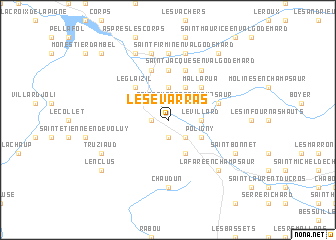
Les Évarras (Provence-Alpes-Côte dʼAzur, France)Les Évarras is a town in the Provence-Alpes-Côte dʼAzur region of France. An overview map of the region around Les Évarras is displayed below.
regional and 3d topo map of Les Évarras, France ::
Les Évarras airports ::
The nearest airport is VAF - Valence Chabeuil, located 85.9 km west of Les Évarras.
Other airports nearby include GNB - Grenoble Saint Geoirs (89.9 km north west), CMF - Chambery Aix Les Bains (103.0 km north), AVN - Avignon Caumont (126.5 km south west), CUF - Levaldigi (128.9 km east), Nearby towns ::
Aubessagne (1.9km north) //
Le Noyer (1.9km south) //
Lacoue (1.3km west) //
Saint-Eusèbe-en-Champsaur (2.3km north east) //
Villeneuve (2.3km south east) //
Le Villard (2.6km east) //
Chauffayer (3.7km north) //
Les Courts (3.2km north east) //
Les Costes (3.9km north) //
Poligny (3.2km south east) //
Les Forestons (3.9km south) //
Pouillardenc (3.2km north west) //
Mallarua (4.5km north east) //
Le Glaizil (4.5km north west) //
LʼHôpital (5.6km north) //
La Motte-en-Champsaur (4.4km north east) //
Lallée (5.7km north) //
Combardenq (5.7km north) //
Saint-Jacques-en-Valgodemard (6.2km north east) //
Les Prés Hauts (7.4km north) //
Chaudun (7.4km south) //
Saint-Firmin-en-Valgodemard (7.5km north) //
Le Villard (7.5km north) //
Les Reculas (7.5km north) //
La Fare-en-Champsaur (6.8km south east) //
Saint-Bonnet (6.4km south east) //
La Broue (7.9km north) //
Les Cypières (6.4km south west) //
Le Pré (6.4km south west) //
[all distances 'as the bird flies' and approximate]  Places with similar names to Les Évarras, France ::
// Los Uveros (PA)
// Los Varias (PA)
// Las Varas (CO)
// Los Faros (GT)
// Los Fierros (GT)
// La Azufrosa (MX)
// La Azufrosa (MX)
// La Azufrosa (MX)
// La Azufrosa (MX)
// Las Varas (MX)
Disclaimer :: Information on this page comes without warranty of any kind |
||
|
Where is Les Évarras? Elevation and coordinates ::
Latitude (lat): 44°43'0"N Longitude (lon): 6°1'0"E
Elevation (approx.): 958m (map arrows pan, magnifying glasses zoom) |
||
|
Visiting Les Évarras? Hotel/Accommodation ::
Book a hotel in Les Évarras Travel Guide ::
Buy a travel guide for France rental cars ::
car rental offers GPS waypoint ::
download a GPX waypoint (PoI) of Les Évarras for your GPS receiver
|
||