|
search place name
|
||
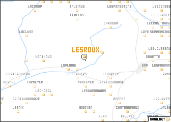
Les Roux (Provence-Alpes-Côte dʼAzur, France)Les Roux is a town in the Provence-Alpes-Côte dʼAzur region of France. An overview map of the region around Les Roux is displayed below.
regional and 3d topo map of Les Roux, France ::
Les Roux airports ::
The nearest airport is VAF - Valence Chabeuil, located 87.4 km north west of Les Roux.
Other airports nearby include GNB - Grenoble Saint Geoirs (100.2 km north west), AVN - Avignon Caumont (113.5 km south west), CMF - Chambery Aix Les Bains (117.4 km north), OBS - Aubenas-vals-lanas Ardeche Meridionale (126.7 km west), Nearby towns ::
La Roche-des-Arnauds (2.3km south west) //
Rabou (3.2km north east) //
Les Lagiers (3.9km south) //
La Plaine (3.2km south west) //
Manteyer (5.6km south) //
Le Burety (5.4km south east) //
Les Durandons (7.5km south) //
La Freissinouse (6.8km south east) //
Pelleautier (8.4km south east) //
Chaudun (8.4km north east) //
Châtillon-le-Désert (9.1km south west) //
[all distances 'as the bird flies' and approximate] 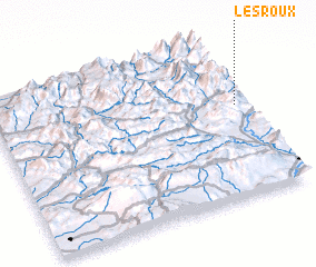 Places with similar names to Les Roux, France ::
// Los Arcos (PH)
// Le Serucce (IT)
// Los Arcos (ES)
// Los Arcos (ES)
// Los Arcos (ES)
// Los Cerricos (ES)
// Los Rocas (ES)
// Los Rocas (ES)
// Lozariegos (ES)
// Los Arcos (MX)
Disclaimer :: Information on this page comes without warranty of any kind |
||
|
Where is Les Roux? Elevation and coordinates ::
Latitude (lat): 44°35'0"N Longitude (lon): 5°58'0"E
Elevation (approx.): 1260m (map arrows pan, magnifying glasses zoom) |
||
|
Visiting Les Roux? Hotel/Accommodation ::
Book a hotel in Les Roux Travel Guide ::
Buy a travel guide for France rental cars ::
car rental offers GPS waypoint ::
download a GPX waypoint (PoI) of Les Roux for your GPS receiver
|
||