|
search place name
|
||
Le Tremblay (Haute-Normandie, France)Le Tremblay is a town in the Haute-Normandie region of France. An overview map of the region around Le Tremblay is displayed below.
regional and 3d topo map of Le Tremblay, France ::

Le Tremblay airports ::
The nearest airport is URO - Rouen Vallee De Seine, located 25.7 km south of Le Tremblay.
Other airports nearby include BVA - Beauvais Tille (61.0 km east), POX - Pontoise Cormeilles En Vexin (77.7 km south east), DOL - Deauville St Gatien (87.0 km west), LEH - Le Havre Octeville (88.0 km west), Nearby towns ::
Grand Parc (1.2km east) //
Rocquemont (1.2km west) //
Écalles (1.9km south) //
Estouteville-Écalles (2.2km south east) //
Beaumont (2.2km north east) //
Saint-Martin-Osmonville (3.7km north) //
Vieux-Manoir (3.7km south) //
Osmonville-sur-Varenne (3.9km north) //
La Prée (3.9km north) //
Colmare (3.0km south west) //
Saint-Martin-du-Plessis (3.0km south east) //
Grand Pré (3.0km south east) //
Clairfeuille (3.0km north east) //
Le Beauthiot (4.4km north west) //
Le Mesnil Godefroy (4.4km south west) //
LʼÉpinay (4.4km south west) //
Yquebeuf (3.6km west) //
Longuerue (5.6km south) //
Mauray (5.7km north) //
Bréquigny (5.7km north) //
Critot (4.1km north west) //
Les Grands Bordeaux (4.1km south east) //
Saint-Aubin (5.7km south) //
Bosc-Bérenger (5.2km north west) //
Montérolier (5.2km north east) //
La Rue-Saint-Pierre (5.2km south west) //
Sainte-Croix-sur-Buchy (5.2km south east) //
Les Authieux (6.1km south east) //
La Frenaye (4.8km east) //
[all distances 'as the bird flies' and approximate] 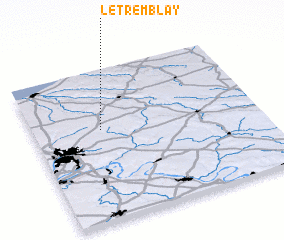 Places with similar names to Le Tremblay, France ::
// La Tremblay (HT)
// Le Tremblay (FR)
// La Trimouille (FR)
// La Tremblaie (FR)
// La Tremblée (FR)
// La Trémouille (FR)
// La Trémouille (FR)
// La Trémouille (FR)
// La Trimouille (FR)
// Le Tremblay (FR)
Disclaimer :: Information on this page comes without warranty of any kind |
||
|
Where is Le Tremblay? Elevation and coordinates ::
Latitude (lat): 49°36'0"N Longitude (lon): 1°18'0"E
Elevation (approx.): 183m (map arrows pan, magnifying glasses zoom) |
||
|
Visiting Le Tremblay? Hotel/Accommodation ::
Book a hotel in Le Tremblay Travel Guide ::
Buy a travel guide for France rental cars ::
car rental offers GPS waypoint ::
download a GPX waypoint (PoI) of Le Tremblay for your GPS receiver
|
||