|
search place name
|
||
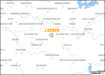
Lombre (Limousin, France)Lombre is a town in the Limousin region of France. An overview map of the region around Lombre is displayed below.
regional and 3d topo map of Lombre, France ::
Lombre airports ::
The nearest airport is LIG - Limoges Bellegarde, located 49.8 km north west of Lombre.
Other airports nearby include BVE - Brive La Roche (63.6 km south), MCU - Montlucon-gueret Montlucon Gueret (75.7 km north east), PGX - Perigueux Bassillac (91.9 km south west), MCU - Montlucon Domerat (97.0 km north east), Nearby towns ::
Plainartige (2.6km east) //
Légaud (3.9km north) //
Lavedrenne (3.2km south west) //
LʼÉglise-aux-Bois (4.5km south east) //
Planchemouton (5.6km north) //
Lacelle (5.4km south east) //
Le Bouchet (5.4km south west) //
Eymoutiers (6.1km north west) //
Trassoudaine (7.4km south) //
Villemonteix (5.2km west) //
Saint-Priest-les-Vergnas (5.2km west) //
Domps (5.5km west) //
Nedde (6.4km north east) //
Sainte-Anne-Saint-Priest (6.4km north west) //
Lauzat (7.6km north east) //
Chassat (8.4km north west) //
[all distances 'as the bird flies' and approximate]  Places with similar names to Lombre, France ::
Disclaimer :: Information on this page comes without warranty of any kind |
||
|
Where is Lombre? Elevation and coordinates ::
Latitude (lat): 45°41'0"N Longitude (lon): 1°46'0"E
Elevation (approx.): 590m (map arrows pan, magnifying glasses zoom) |
||
|
Visiting Lombre? Hotel/Accommodation ::
Book a hotel in Lombre Travel Guide ::
Buy a travel guide for France rental cars ::
car rental offers GPS waypoint ::
download a GPX waypoint (PoI) of Lombre for your GPS receiver
|
||