|
search place name
|
||
Longes (Rhône-Alpes, France)Longes is a town in the Rhône-Alpes region of France. An overview map of the region around Longes is displayed below.
regional and 3d topo map of Longes, France ::

Longes airports ::
The nearest airport is EBU - St.-etienne Boutheon, located 30.6 km west of Longes.
Other airports nearby include LYN - Lyon Bron (32.4 km north east), LYS - Lyon Saint Exupery (40.5 km north east), XVF - Vilefrance Tarare (44.8 km north), GNB - Grenoble Saint Geoirs (52.8 km east), Nearby towns ::
Chassenoud (1.3km east) //
Disimieux (2.3km north west) //
Tréves (3.9km north) //
Pavezin (3.9km south) //
Sainte-Croix-en-Jarez (3.2km south west) //
Châteauneuf (4.5km north west) //
La Chapelle-Villars (4.5km south east) //
Tartaras (5.7km north) //
Chuyer (5.7km south) //
Le Grand Valluy (5.4km south west) //
Échalas (6.1km north east) //
Le Coin (6.1km north east) //
Granay (5.2km west) //
Les Haies (5.2km east) //
Couzon (5.5km west) //
Seyou (5.5km west) //
Dargoire (7.5km north) //
Rive-de-Gier (6.4km north west) //
Saint-Romain-en-Gier (7.9km north) //
Saint-Joseph (7.6km north west) //
Saint-Michel-sur-Rhône (7.6km south east) //
Vérin (7.6km south east) //
Verlieux (9.1km south east) //
[all distances 'as the bird flies' and approximate] 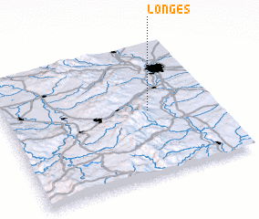 Places with similar names to Longes, France ::
Disclaimer :: Information on this page comes without warranty of any kind |
||
|
Where is Longes? Elevation and coordinates ::
Latitude (lat): 45°30'0"N Longitude (lon): 4°41'0"E
Elevation (approx.): 479m (map arrows pan, magnifying glasses zoom) |
||
|
Visiting Longes? Hotel/Accommodation ::
Book a hotel in Longes Travel Guide ::
Buy a travel guide for France rental cars ::
car rental offers GPS waypoint ::
download a GPX waypoint (PoI) of Longes for your GPS receiver
|
||