|
search place name
|
||
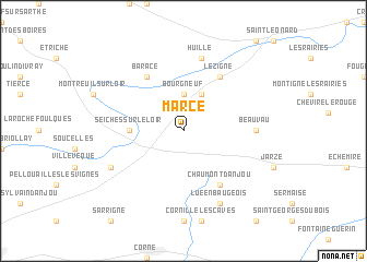
Marcé (Pays de la Loire, France)Marcé is a town in the Pays de la Loire region of France. An overview map of the region around Marcé is displayed below.
regional and 3d topo map of Marcé, France ::
Marcé airports ::
The nearest airport is LME - Le Mans Arnage, located 56.2 km north east of Marcé.
Other airports nearby include LVA - Laval Entrammes (59.2 km north west), CET - Cholet Le Pontreau (70.0 km south west), TUF - Tours Val De Loire (80.4 km east), NTE - Nantes Atlantique (108.8 km south west), Nearby towns ::
Bourgneuf (3.7km north) //
La Chapelle-Saint-Laud (3.9km north) //
Seiches-sur-le-Loir (3.8km west) //
Baracé (6.1km north west) //
Lézigné (6.1km north east) //
Chaumont-dʼAnjou (6.1km south east) //
Beauvau (5.0km east) //
Huillé (7.5km north) //
Corzé (6.2km south west) //
Lué-en-Baugeois (7.8km south) //
[all distances 'as the bird flies' and approximate]  Places with similar names to Marcé, France ::
Disclaimer :: Information on this page comes without warranty of any kind |
||
|
Where is Marcé? Elevation and coordinates ::
Latitude (lat): 47°35'0"N Longitude (lon): 0°19'0"W
Elevation (approx.): 54m (map arrows pan, magnifying glasses zoom) |
||
|
Visiting Marcé? Hotel/Accommodation ::
Book a hotel in Marcé Travel Guide ::
Buy a travel guide for France rental cars ::
car rental offers GPS waypoint ::
download a GPX waypoint (PoI) of Marcé for your GPS receiver
|
||