|
search place name
|
||
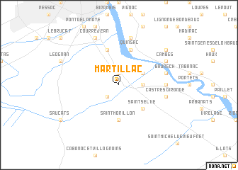
Martillac (Aquitaine, France)Martillac is a town in the Aquitaine region of France. An overview map of the region around Martillac is displayed below.
regional and 3d topo map of Martillac, France ::
Martillac airports ::
The nearest airport is BOD - Bordeaux Merignac, located 21.2 km north west of Martillac.
Other airports nearby include XAC - Arcachon La Teste De Buch (48.5 km west), EGC - Bergerac Roumaniere (83.1 km east), AGF - Agen La Garenne (105.7 km south east), CNG - Cognac Chateaubernard (107.6 km north), Nearby towns ::
Saint-Médard-dʼEyrans (1.9km north) //
Labrède (2.3km south west) //
Ayguemorte-les-Graves (2.6km east) //
Isle-Saint-Georges (3.2km north east) //
Saint-Selve (4.5km south east) //
Saint-Morillon (5.6km south) //
Cadaujac (5.7km north) //
Quinsac (5.7km north) //
Beautiran (5.3km east) //
Baurech (5.6km east) //
Camblanes-et-Meynac (7.5km north) //
Castres-Gironde (5.6km east) //
Cambes (6.4km north east) //
Villenave-dʼOrnon (7.9km north) //
Courrejean (7.9km north) //
Saint-Caprais-de-Bordeaux (7.7km north east) //
[all distances 'as the bird flies' and approximate] 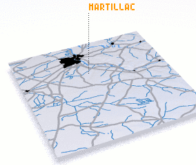 Places with similar names to Martillac, France ::
// Martellago (IT)
// Maratalakh (RU)
// Muarataloke (ID)
// Mairudi Luk (PK)
// Mordialloc (AU)
// Mortlake (AU)
// Mortlake (AU)
// Mörtelek (SE)
Disclaimer :: Information on this page comes without warranty of any kind |
||
|
Where is Martillac? Elevation and coordinates ::
Latitude (lat): 44°42'0"N Longitude (lon): 0°31'0"W
Elevation (approx.): 17m (map arrows pan, magnifying glasses zoom) |
||
|
Visiting Martillac? Hotel/Accommodation ::
Book a hotel in Martillac Travel Guide ::
Buy a travel guide for France rental cars ::
car rental offers GPS waypoint ::
download a GPX waypoint (PoI) of Martillac for your GPS receiver
|
||