|
search place name
|
||
Mombert (Midi-Pyrénées, France)Mombert is a town in the Midi-Pyrénées region of France. An overview map of the region around Mombert is displayed below.
regional and 3d topo map of Mombert, France ::

Mombert airports ::
The nearest airport is AGF - Agen La Garenne, located 58.5 km north of Mombert.
Other airports nearby include LDE - Tarbes Lourdes (63.4 km south west), PUF - Pau Pyrenees (73.4 km south west), LRH - La Rochelle Lherm (73.8 km east), TLS - Toulouse Blagnac (77.9 km east), Nearby towns ::
Le Brouilh (1.3km west) //
Biran (3.9km north) //
Mirannes (5.7km south) //
Riguepeu (4.4km south west) //
Bezolles (5.5km south west) //
Saint-Arailles (5.5km south west) //
Saint-Jean-Poutge (7.5km north) //
LʼIsle-de-Noé (7.5km south) //
Barran (6.9km south east) //
Antras (8.4km north east) //
Caillavet (7.7km north west) //
[all distances 'as the bird flies' and approximate] 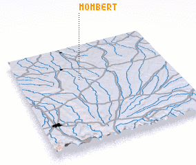 Places with similar names to Mombert, France ::
// Momart (DE)
// Mäemurati (EE)
// Mumurdia (BD)
// Mumbaradó (CO)
// Memberiete (CD)
// Maymorita (MX)
// Mamar Do (IR)
// Mambouroudou (GN)
// Mamourodou (GN)
// Mamourdi (CM)
Disclaimer :: Information on this page comes without warranty of any kind |
||
|
Where is Mombert? Elevation and coordinates ::
Latitude (lat): 43°40'0"N Longitude (lon): 0°24'0"W
Elevation (approx.): 119m (map arrows pan, magnifying glasses zoom) |
||
|
Visiting Mombert? Hotel/Accommodation ::
Book a hotel in Mombert Travel Guide ::
Buy a travel guide for France rental cars ::
car rental offers GPS waypoint ::
download a GPX waypoint (PoI) of Mombert for your GPS receiver
|
||