|
search place name
|
||
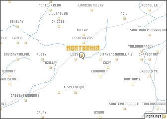
Montarmin (Bourgogne, France)Montarmin is a town in the Bourgogne region of France. An overview map of the region around Montarmin is displayed below.
regional and 3d topo map of Montarmin, France ::
Montarmin airports ::
The nearest airport is XMU - Moulins Montbeugny, located 51.0 km south west of Montarmin.
Other airports nearby include XCD - Chalon Champforgeuil (63.9 km east), NVS - Nevers Fourchambault (70.6 km west), RNE - Roanne Renaison (80.6 km south), VHY - Vichy Charmeil (81.5 km south west), Nearby towns ::
Luzy (1.3km west) //
Les Hérards (3.7km north) //
Les Bonnots (2.5km east) //
Champoux (4.5km south east) //
Millay (5.6km north) //
Cuzy (4.2km south east) //
Vitry-en-Charollais (5.1km east) //
Tazilly (5.4km west) //
Issy-lʼÉvêque (7.5km south) //
Marly-sous-Issy (8.3km south west) //
Chiddes (8.3km north west) //
[all distances 'as the bird flies' and approximate] 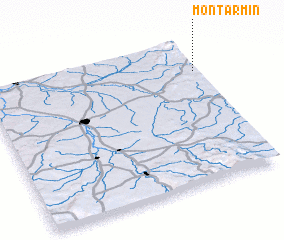 Places with similar names to Montarmin, France ::
// Monteromano (IT)
// Monte Romano (IT)
Disclaimer :: Information on this page comes without warranty of any kind |
||
|
Where is Montarmin? Elevation and coordinates ::
Latitude (lat): 46°47'0"N Longitude (lon): 3°59'0"E
Elevation (approx.): 271m (map arrows pan, magnifying glasses zoom) |
||
|
Visiting Montarmin? Hotel/Accommodation ::
Book a hotel in Montarmin Travel Guide ::
Buy a travel guide for France rental cars ::
car rental offers GPS waypoint ::
download a GPX waypoint (PoI) of Montarmin for your GPS receiver
|
||