|
search place name
|
||
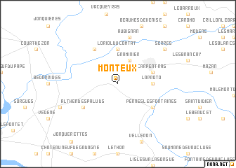
Monteux (Provence-Alpes-Côte dʼAzur, France)Monteux is a town in the Provence-Alpes-Côte dʼAzur region of France. An overview map of the region around Monteux is displayed below.
regional and 3d topo map of Monteux, France ::
Monteux airports ::
The nearest airport is AVN - Avignon Caumont, located 16.1 km south west of Monteux.
Other airports nearby include FNI - Nimes Garons (56.0 km south west), QXB - Aix-les-milles Aix Les Milles (65.7 km south east), MRS - Marseille Provence (68.6 km south), OBS - Aubenas-vals-lanas Ardeche Meridionale (75.7 km north west), Nearby towns ::
Graminier (3.9km north) //
Loriol-du-Comtat (5.6km north) //
La Proto (4.0km east) //
Carpentras (4.4km north east) //
Sarrians (6.2km north west) //
Althen-des-Paluds (5.5km south west) //
Pernes-les-Fontaines (5.5km south east) //
Aubignan (7.5km north) //
Serres (7.7km north east) //
[all distances 'as the bird flies' and approximate]  Places with similar names to Monteux, France ::
// Manteigas (PT)
// Mendigos (PT)
// Moniatycze (PL)
// Mandagas (LV)
// Manatikosy (MG)
// Minnetex (US)
// Mandiquice (MZ)
// Monteaux (FR)
// Manducas (BR)
// Mandaix (FR)
Disclaimer :: Information on this page comes without warranty of any kind |
||
|
Where is Monteux? Elevation and coordinates ::
Latitude (lat): 44°2'0"N Longitude (lon): 5°0'0"E
Elevation (approx.): 46m (map arrows pan, magnifying glasses zoom) |
||
|
Visiting Monteux? Hotel/Accommodation ::
Book a hotel in Monteux Travel Guide ::
Buy a travel guide for France rental cars ::
car rental offers GPS waypoint ::
download a GPX waypoint (PoI) of Monteux for your GPS receiver
|
||