|
search place name
|
||
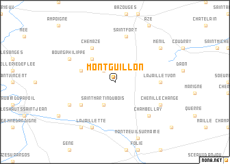
Montguillon (Pays de la Loire, France)Montguillon is a town in the Pays de la Loire region of France. An overview map of the region around Montguillon is displayed below.
regional and 3d topo map of Montguillon, France ::
Montguillon airports ::
The nearest airport is LVA - Laval Entrammes, located 33.1 km north of Montguillon.
Other airports nearby include CET - Cholet Le Pontreau (73.2 km south), LME - Le Mans Arnage (74.0 km east), RNS - Rennes St Jacques (83.7 km north west), NTE - Nantes Atlantique (92.4 km south west), Nearby towns ::
Molière (2.2km north west) //
Saint-Martin-du-Bois (3.9km south) //
Le Bailleul (4.5km north west) //
Saint-Sauveur-de-Flée (4.2km north west) //
Aviré (5.3km south west) //
Chemazé (6.1km north west) //
La Jaille-Yvon (5.0km east) //
Saint-Fort (7.5km north) //
Chambellay (6.7km south east) //
Chenillé-Changé (6.2km south east) //
La Jaillette (7.8km south) //
Louvaines (6.2km south west) //
Bourg-Philippe (6.2km north west) //
Andigné (8.3km south west) //
Ménil (7.5km north east) //
[all distances 'as the bird flies' and approximate]  Places with similar names to Montguillon, France ::
// Montagliano (IT)
// Montaglioni (IT)
// Monte Galán (CR)
// Monte Galán (CR)
// Monte Galán (HN)
// Mount Coolon (AU)
// Montéglin (FR)
Disclaimer :: Information on this page comes without warranty of any kind |
||
|
Where is Montguillon? Elevation and coordinates ::
Latitude (lat): 47°44'0"N Longitude (lon): 0°44'0"W
Elevation (approx.): 77m (map arrows pan, magnifying glasses zoom) |
||
|
Visiting Montguillon? Hotel/Accommodation ::
Book a hotel in Montguillon Travel Guide ::
Buy a travel guide for France rental cars ::
car rental offers GPS waypoint ::
download a GPX waypoint (PoI) of Montguillon for your GPS receiver
|
||