|
search place name
|
||
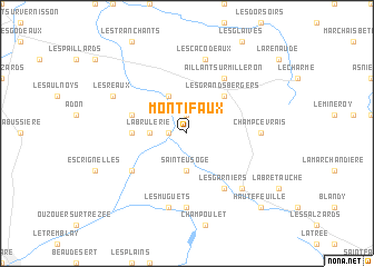
Montifaux (Bourgogne, France)Montifaux is a town in the Bourgogne region of France. An overview map of the region around Montifaux is displayed below.
regional and 3d topo map of Montifaux, France ::
Montifaux airports ::
The nearest airport is AUF - Auxerre Branches, located 46.1 km east of Montifaux.
Other airports nearby include NVS - Nevers Fourchambault (84.6 km south), BOU - Bourges (86.7 km south west), ORE - Orleans Bricy (89.3 km west), QYR - Troyes Barberey (104.8 km north east), Nearby towns ::
Rogny (1.2km west) //
Les Toulerons (1.9km north) //
La Brûlerie (2.5km west) //
Saint-Eusoge (3.7km south) //
Dammarie-sur-Loing (3.9km north) //
Les Grands Bergers (4.5km north east) //
Feins-en-Gâtinais (3.7km west) //
Les Copeaux (4.2km north west) //
Aillant-sur-Milleron (6.1km north east) //
Les Garniers (6.1km south east) //
Le Grand Chaloy (5.3km south west) //
Breteau (7.4km south) //
Champcevrais (5.0km east) //
Les Cacodeaux (7.5km north) //
Les Muguets (7.5km south) //
Bléneau (6.7km south east) //
Les Réaux (6.2km north west) //
Hautefeuille (8.9km south east) //
[all distances 'as the bird flies' and approximate]  Places with similar names to Montifaux, France ::
Disclaimer :: Information on this page comes without warranty of any kind |
||
|
Where is Montifaux? Elevation and coordinates ::
Latitude (lat): 47°45'0"N Longitude (lon): 2°54'0"E
Elevation (approx.): 167m (map arrows pan, magnifying glasses zoom) |
||
|
Visiting Montifaux? Hotel/Accommodation ::
Book a hotel in Montifaux Travel Guide ::
Buy a travel guide for France rental cars ::
car rental offers GPS waypoint ::
download a GPX waypoint (PoI) of Montifaux for your GPS receiver
|
||