|
search place name
|
||
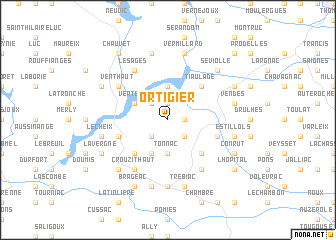
Ortigier (Auvergne, France)Ortigier is a town in the Auvergne region of France. An overview map of the region around Ortigier is displayed below.
regional and 3d topo map of Ortigier, France ::
Ortigier airports ::
The nearest airport is AUR - Aurillac, located 44.1 km south of Ortigier.
Other airports nearby include BVE - Brive La Roche (69.5 km west), CFE - Clermont Ferrand Auvergne (86.0 km north east), RDZ - Rodez Marcillac (98.0 km south), MCU - Montlucon-gueret Montlucon Gueret (104.4 km north), Nearby towns ::
Arches (1.9km north) //
Sourniac (1.3km east) //
Le Fanc (2.3km south west) //
Les Andrieux (2.3km north west) //
Bourianne (2.3km south east) //
Boulan (3.7km south) //
Tonnac (3.7km south) //
La Jarrige (3.7km north) //
Aimons (3.9km south) //
Vent-Bas (3.2km north west) //
La Besse (4.5km south west) //
Boissières (4.5km south east) //
Tiaulade (4.5km north east) //
Furlange (4.5km north east) //
Jaleyrac (4.3km south east) //
La Forestie (4.3km south west) //
Les Ages (6.1km north west) //
Crouzit Haut (6.1km south west) //
Vent-Haut (5.4km north west) //
Le Vigean (6.1km south east) //
Mauriac (7.4km south) //
Le Cheix (5.5km west) //
Saint-Thomas (7.5km south) //
Trébiac (7.5km south) //
Janconie (7.5km north) //
Estillols (5.5km east) //
Mongrous (5.5km east) //
Vendes (5.5km east) //
Vermillard (7.5km north) //
[all distances 'as the bird flies' and approximate]  Places with similar names to Ortigier, France :: Disclaimer :: Information on this page comes without warranty of any kind |
||
|
Where is Ortigier? Elevation and coordinates ::
Latitude (lat): 45°17'0"N Longitude (lon): 2°20'0"E
Elevation (approx.): 683m (map arrows pan, magnifying glasses zoom) |
||
|
Visiting Ortigier? Hotel/Accommodation ::
Book a hotel in Ortigier Travel Guide ::
Buy a travel guide for France rental cars ::
car rental offers GPS waypoint ::
download a GPX waypoint (PoI) of Ortigier for your GPS receiver
|
||