|
search place name
|
||
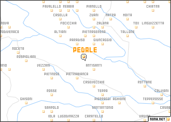
Pedale (France)Pedale is a town in France. An overview map of the region around Pedale is displayed below.
regional and 3d topo map of Pedale, France ::
Pedale airports ::
The nearest airport is SOZ - Solenzara, located 29.4 km south of Pedale.
Other airports nearby include BIA - Bastia Poretta (42.9 km north), AJA - Ajaccio Campo Dell Oro (52.5 km south west), CLY - Calvi Saint Catherine (58.9 km north west), FSC - Figari Sud Corse (78.3 km south), Nearby towns ::
Antisanti (2.3km south east) //
Pietra Bianca (4.0km south) //
Paradiso (4.0km north) //
Pancheraccia (4.0km north) //
Giuncaggio (4.6km north east) //
Piedicorte-di-Gaggio (5.6km north) //
Pietraserena (5.7km north) //
Casevecchie (5.7km south) //
Ampriani (7.5km north) //
Altiani (6.9km north west) //
Pietroso (6.6km south west) //
Teppa (7.9km south) //
Focicchia (7.9km north) //
Zalana (7.9km north) //
Rosse (9.2km south west) //
[all distances 'as the bird flies' and approximate] 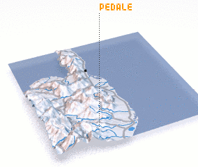 Places with similar names to Pedale, France ::
Disclaimer :: Information on this page comes without warranty of any kind |
||
|
Where is Pedale? Elevation and coordinates ::
Latitude (lat): 42°11'0"N Longitude (lon): 9°20'0"E
Elevation (approx.): 311m (map arrows pan, magnifying glasses zoom) |
||
|
Visiting Pedale? Hotel/Accommodation ::
Book a hotel in Pedale Travel Guide ::
Buy a travel guide for France rental cars ::
car rental offers GPS waypoint ::
download a GPX waypoint (PoI) of Pedale for your GPS receiver
|
||