|
search place name
|
||
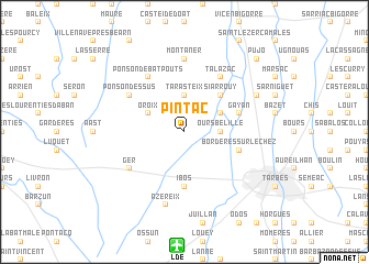
Pintac (Midi-Pyrénées, France)Pintac is a town in the Midi-Pyrénées region of France. An overview map of the region around Pintac is displayed below.
regional and 3d topo map of Pintac, France ::
Pintac airports ::
The nearest airport is LDE - Tarbes Lourdes, located 11.6 km south of Pintac.
Other airports nearby include PUF - Pau Pyrenees (35.6 km west), LRH - La Rochelle Lherm (104.0 km east), AGF - Agen La Garenne (109.9 km north east), TLS - Toulouse Blagnac (116.9 km east), Nearby towns ::
Oursbelille (2.7km east) //
Tarasteix (3.7km north) //
Oroix (3.3km north west) //
Lagarde (3.3km north east) //
Siarrouy (4.6km north east) //
Ibos (5.6km south) //
Bordères-sur-lʼÉchez (4.5km south east) //
Gayan (4.5km north east) //
Ponson-Debat-Pouts (6.2km north west) //
Talazac (6.2km north east) //
Ger (5.5km south west) //
Ponson-Dessus (5.5km north west) //
Montaner (7.4km north) //
Azereix (7.5km south) //
Andrest (6.5km north east) //
Pujo (9.2km north east) //
[all distances 'as the bird flies' and approximate]  Places with similar names to Pintac, France ::
// Panteik (MM)
// Pontaga (MM)
// Pine Tuckey (US)
// Pinetucky (US)
// Pan Tak (US)
// Pentik (MY)
// Ponteggia (IT)
// Poniatówka (PL)
// Pintic (RO)
// Pintic (RO)
Disclaimer :: Information on this page comes without warranty of any kind |
||
|
Where is Pintac? Elevation and coordinates ::
Latitude (lat): 43°17'0"N Longitude (lon): 0°0'0"W
Elevation (approx.): 312m (map arrows pan, magnifying glasses zoom) |
||
|
Visiting Pintac? Hotel/Accommodation ::
Book a hotel in Pintac Travel Guide ::
Buy a travel guide for France rental cars ::
car rental offers GPS waypoint ::
download a GPX waypoint (PoI) of Pintac for your GPS receiver
|
||