|
search place name
|
||
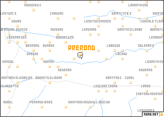
Pré Rond (Rhône-Alpes, France)Pré Rond is a town in the Rhône-Alpes region of France. An overview map of the region around Pré Rond is displayed below.
regional and 3d topo map of Pré Rond, France ::
Pré Rond airports ::
The nearest airport is AVN - Avignon Caumont, located 64.4 km south west of Pré Rond.
Other airports nearby include QXB - Aix-les-milles Aix Les Milles (82.4 km south), VAF - Valence Chabeuil (90.0 km north west), MRS - Marseille Provence (93.1 km south), OBS - Aubenas-vals-lanas Ardeche Meridionale (101.3 km west), Nearby towns ::
Vers-sur-Méouge (1.3km west) //
Voluy (1.9km north) //
Izon-la-Bruisse (3.2km north east) //
Séderon (4.6km south west) //
Sommecure (4.6km north west) //
Eygalayes (4.0km east) //
Villefranche-le-Château (4.4km south west) //
Le Ruinas (5.7km north) //
Laborel (6.2km north east) //
La Bègüe (5.6km east) //
Morins (5.6km west) //
Aumage (5.6km west) //
Ruissas (6.8km north west) //
Les Omergues (7.9km south) //
Les Eyssenières (7.9km north) //
Montauban-sur-lʼOuvèze (6.5km north west) //
Les Chantrons (8.4km south east) //
Montfroc (7.7km south east) //
Barret-de-Lioure (7.7km south west) //
La Bègüe (9.1km south east) //
[all distances 'as the bird flies' and approximate]  Places with similar names to Pré Rond, France ::
// Pirarenda (BO)
Disclaimer :: Information on this page comes without warranty of any kind |
||
|
Where is Pré Rond? Elevation and coordinates ::
Latitude (lat): 44°14'0"N Longitude (lon): 5°34'0"E
Elevation (approx.): 829m (map arrows pan, magnifying glasses zoom) |
||
|
Visiting Pré Rond? Hotel/Accommodation ::
Book a hotel in Pré Rond Travel Guide ::
Buy a travel guide for France rental cars ::
car rental offers GPS waypoint ::
download a GPX waypoint (PoI) of Pré Rond for your GPS receiver
|
||