|
search place name
|
||
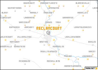
Reclancourt (Champagne-Ardenne, France)Reclancourt is a town in the Champagne-Ardenne region of France. An overview map of the region around Reclancourt is displayed below.
regional and 3d topo map of Reclancourt, France ::
Reclancourt airports ::
The nearest airport is EPL - Epinal Mirecourt, located 72.2 km east of Reclancourt.
Other airports nearby include QYR - Troyes Barberey (87.3 km west), DIJ - Dijon Longvic (94.4 km south), ENC - Nancy Essey (102.4 km north east), DLE - Dole Tavaux (121.6 km south), Nearby towns ::
Chaumont (1.2km west) //
Buxereuilles (2.2km north west) //
Choignes (2.2km south east) //
Condes (3.7km north) //
Chamarandes (3.7km south) //
Brethenay (3.9km north) //
Brottes (3.9km south) //
Treix (4.5km north east) //
Verbiesles (6.1km south east) //
Riaucourt (7.4km north) //
Neuilly-sur-Suize (7.4km south) //
Jonchery (5.3km west) //
Luzy-sur-Marne (7.8km south) //
Marault (8.3km north west) //
Darmannes (7.4km north east) //
Laharmand (7.4km north west) //
[all distances 'as the bird flies' and approximate] 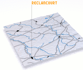 Places with similar names to Reclancourt, France ::
// Roclincourt (FR)
Disclaimer :: Information on this page comes without warranty of any kind |
||
|
Where is Reclancourt? Elevation and coordinates ::
Latitude (lat): 48°7'0"N Longitude (lon): 5°9'0"E
Elevation (approx.): 263m (map arrows pan, magnifying glasses zoom) |
||
|
Visiting Reclancourt? Hotel/Accommodation ::
Book a hotel in Reclancourt Travel Guide ::
Buy a travel guide for France rental cars ::
car rental offers GPS waypoint ::
download a GPX waypoint (PoI) of Reclancourt for your GPS receiver
|
||