|
search place name
|
||
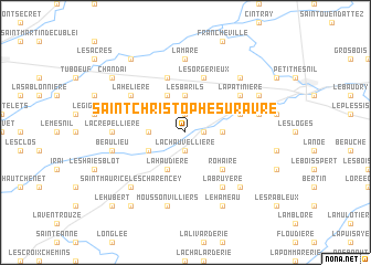
Saint-Christophe-sur-Avre (Haute-Normandie, France)Saint-Christophe-sur-Avre is a town in the Haute-Normandie region of France. An overview map of the region around Saint-Christophe-sur-Avre is displayed below.
regional and 3d topo map of Saint-Christophe-sur-Avre, France ::
Saint-Christophe-sur-Avre airports ::
The nearest airport is URO - Rouen Vallee De Seine, located 80.5 km north of Saint-Christophe-sur-Avre.
Other airports nearby include DOL - Deauville St Gatien (88.4 km north west), TNF - Toussous-le-noble Toussus Le Noble (95.0 km east), LME - Le Mans Arnage (95.2 km south west), POX - Pontoise Cormeilles En Vexin (100.0 km north east), Nearby towns ::
La Minglière (1.2km east) //
La Forêt (1.9km north) //
Armentières-sur-Avre (1.9km south) //
La Chauvellière (1.9km south) //
Les Barils (3.7km north) //
Saint-Victor-sur-Avre (2.4km east) //
Gournay (2.4km west) //
Bouhours (3.9km north) //
La Haudière (3.9km south) //
Chennebrun (3.1km south west) //
Rohaire (4.4km south east) //
Les Orgérieux (5.7km north) //
Le Minerai (5.7km north) //
La Fauvellière (4.1km north east) //
La Hélière (5.2km north west) //
La Patinière (5.2km north east) //
La Bruyère (6.1km south east) //
Bourth (7.4km north) //
La Mare (7.4km north) //
La Boutignière (4.9km west) //
La Crepellière (4.9km west) //
La Chabotière (5.2km east) //
Beaulieu (5.2km west) //
Moussonvilliers (7.5km south) //
Mandres (6.7km north east) //
Saint-Maurice-lès-Charencey (6.7km south west) //
La Chapelle-Fortin (6.7km south east) //
Pullay (6.1km north east) //
Le Hameau (7.8km south) //
[all distances 'as the bird flies' and approximate] 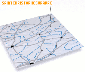 Places with similar names to Saint-Christophe-sur-Avre, France :: Disclaimer :: Information on this page comes without warranty of any kind |
||
|
Where is Saint-Christophe-sur-Avre? Elevation and coordinates ::
Latitude (lat): 48°42'0"N Longitude (lon): 0°49'0"W
Elevation (approx.): 199m (map arrows pan, magnifying glasses zoom) |
||
|
Visiting Saint-Christophe-sur-Avre? Hotel/Accommodation ::
Book a hotel in Saint-Christophe-sur-Avre Travel Guide ::
Buy a travel guide for France rental cars ::
car rental offers GPS waypoint ::
download a GPX waypoint (PoI) of Saint-Christophe-sur-Avre for your GPS receiver
|
||