|
search place name
|
||
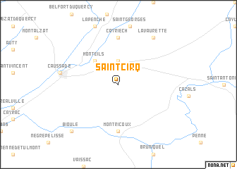
Saint-Cirq (Midi-Pyrénées, France)Saint-Cirq is a town in the Midi-Pyrénées region of France. An overview map of the region around Saint-Cirq is displayed below.
regional and 3d topo map of Saint-Cirq, France ::
Saint-Cirq airports ::
The nearest airport is LBI - Albi Le Sequestre, located 47.7 km south east of Saint-Cirq.
Other airports nearby include TLS - Toulouse Blagnac (61.3 km south), RDZ - Rodez Marcillac (74.8 km north east), AGF - Agen La Garenne (82.1 km west), LRH - La Rochelle Lherm (82.9 km south), Nearby towns ::
Septfonds (3.7km north) //
Monteils (4.6km north west) //
Montricoux (7.4km south) //
Cayriech (7.4km north) //
Lavaurette (8.4km north east) //
Bioule (9.1km south west) //
[all distances 'as the bird flies' and approximate] 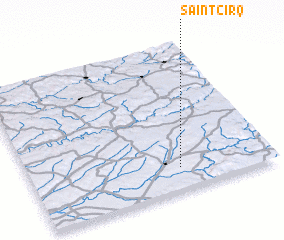 Places with similar names to Saint-Cirq, France ::
Disclaimer :: Information on this page comes without warranty of any kind |
||
|
Where is Saint-Cirq? Elevation and coordinates ::
Latitude (lat): 44°9'0"N Longitude (lon): 1°37'0"E
Elevation (approx.): 169m (map arrows pan, magnifying glasses zoom) |
||
|
Visiting Saint-Cirq? Hotel/Accommodation ::
Book a hotel in Saint-Cirq Travel Guide ::
Buy a travel guide for France rental cars ::
car rental offers GPS waypoint ::
download a GPX waypoint (PoI) of Saint-Cirq for your GPS receiver
|
||