|
search place name
|
||
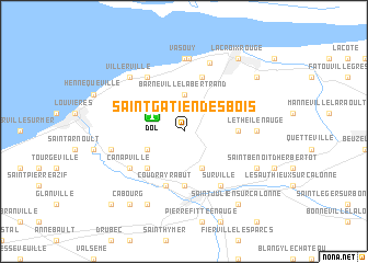
Saint-Gâtien-des-Bois (Basse-Normandie, France)Saint-Gâtien-des-Bois is a town in the Basse-Normandie region of France. An overview map of the region around Saint-Gâtien-des-Bois is displayed below.
regional and 3d topo map of Saint-Gâtien-des-Bois, France ::
Saint-Gâtien-des-Bois airports ::
The nearest airport is DOL - Deauville St Gatien, located 2.7 km north west of Saint-Gâtien-des-Bois.
Other airports nearby include LEH - Le Havre Octeville (21.6 km north), CFR - Caen Carpiquet (50.1 km south west), URO - Rouen Vallee De Seine (72.1 km east), CER - Cherbourg Maupertus (124.3 km west), Nearby towns ::
Barneville-la-Bertrand (3.7km north) //
Englesqueville-en-Auge (3.0km south west) //
Tourville-en-Auge (3.9km south) //
Saint-Martin-aux-Chartrains (4.4km south west) //
Fourneville (3.6km east) //
Pont-lʼÉvêque (5.6km south) //
Coudray-Rabut (5.7km south) //
Équemauville (5.7km north) //
Cricquebœuf (6.1km north west) //
Canapville (5.2km south west) //
Surville (6.1km south east) //
Vasouy (7.4km north) //
Pennedepie (7.4km north) //
Le Theil-en-Auge (4.8km east) //
La Bouillette (7.4km north) //
Le Val de la Reine (7.2km north) //
Bonneville-sur-Touques (5.2km west) //
Villerville (6.6km north west) //
Reux (7.8km south) //
Vieux-Bourg (6.1km south east) //
Gonneville-sur-Honfleur (7.4km north east) //
Saint-Julien-sur-Calonne (8.3km south east) //
Honfleur (8.2km north east) //
Côte de Grâce (8.2km north east) //
La Croix Rouge (8.2km north east) //
Cabourg (8.3km south west) //
Beaumont-en-Auge (8.8km south west) //
Saint-Étienne-la-Thillaye (8.8km south west) //
[all distances 'as the bird flies' and approximate] 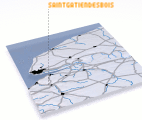 Places with similar names to Saint-Gâtien-des-Bois, France :: Disclaimer :: Information on this page comes without warranty of any kind |
||
|
Where is Saint-Gâtien-des-Bois? Elevation and coordinates ::
Latitude (lat): 49°21'0"N Longitude (lon): 0°11'0"W
Elevation (approx.): 147m (map arrows pan, magnifying glasses zoom) |
||
|
Visiting Saint-Gâtien-des-Bois? Hotel/Accommodation ::
Book a hotel in Saint-Gâtien-des-Bois Travel Guide ::
Buy a travel guide for France rental cars ::
car rental offers GPS waypoint ::
download a GPX waypoint (PoI) of Saint-Gâtien-des-Bois for your GPS receiver
|
||