|
search place name
|
||
Saint-Sauvier (Auvergne, France)Saint-Sauvier is a town in the Auvergne region of France. An overview map of the region around Saint-Sauvier is displayed below.
regional and 3d topo map of Saint-Sauvier, France ::

Saint-Sauvier airports ::
The nearest airport is MCU - Montlucon-gueret Montlucon Gueret, located 18.0 km south of Saint-Sauvier.
Other airports nearby include MCU - Montlucon Domerat (18.6 km east), CHR - Chateauroux Deols (70.5 km north west), BOU - Bourges (75.1 km north), XMU - Moulins Montbeugny (85.4 km east), Nearby towns ::
Le Coret (1.9km south) //
Herculat (1.9km south) //
Sugère (1.3km east) //
Saint-Rémy (1.9km north) //
Vieille-Vigne (2.3km north east) //
La Valade (3.7km south) //
Pauliat (3.7km south) //
Treignat (3.7km south) //
La Vierne (2.6km west) //
Les Maisons (2.6km east) //
La Ville-Brûlant (3.9km north) //
La Barre (3.2km north east) //
La Ville-Raymond (4.5km north west) //
Pierrefitte (5.6km north) //
La Forêt (5.6km north) //
Leyrat (4.3km south west) //
Mesples (5.7km north) //
LʼAge-Goyard (5.7km north) //
Saint-Palais (6.1km north west) //
Les Trois Taillants (6.1km south east) //
Le Monceau (6.1km south east) //
Le Mazurier (7.4km south) //
La Croix (5.1km east) //
Les Moutats (7.4km north) //
Chateux (7.5km south) //
Saint-Pierre-le-Bost (5.4km west) //
Pruges (7.5km north) //
Péjaudier (7.5km north) //
Sermasse (7.5km north) //
[all distances 'as the bird flies' and approximate] 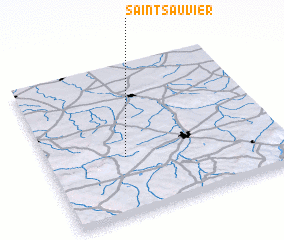 Places with similar names to Saint-Sauvier, France ::
// Santa Severa (IT)
// Sneads Ferry (US)
// Saint Sauveur (DM)
// Saint-Sauveur (GP)
// Sainte-Sévère (FR)
// Saint-Sauveur (FR)
// Saint-Sauveur (FR)
// Saint-Sauveur (FR)
// Saint-Sauveur (FR)
// Saint-Sauveur (FR)
Disclaimer :: Information on this page comes without warranty of any kind |
||
|
Where is Saint-Sauvier? Elevation and coordinates ::
Latitude (lat): 46°23'0"N Longitude (lon): 2°20'0"E
Elevation (approx.): 460m (map arrows pan, magnifying glasses zoom) |
||
|
Visiting Saint-Sauvier? Hotel/Accommodation ::
Book a hotel in Saint-Sauvier Travel Guide ::
Buy a travel guide for France rental cars ::
car rental offers GPS waypoint ::
download a GPX waypoint (PoI) of Saint-Sauvier for your GPS receiver
|
||