|
search place name
|
||
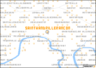
Saint-Wandrille-Rançon (Haute-Normandie, France)Saint-Wandrille-Rançon is a town in the Haute-Normandie region of France. An overview map of the region around Saint-Wandrille-Rançon is displayed below.
regional and 3d topo map of Saint-Wandrille-Rançon, France ::
Saint-Wandrille-Rançon airports ::
The nearest airport is URO - Rouen Vallee De Seine, located 33.9 km south east of Saint-Wandrille-Rançon.
Other airports nearby include DOL - Deauville St Gatien (48.2 km south west), LEH - Le Havre Octeville (49.1 km west), CFR - Caen Carpiquet (97.0 km south west), BVA - Beauvais Tille (97.9 km east), Nearby towns ::
Caudebecquet (1.9km south) //
Le Haut Pas (1.2km west) //
Le Pavillon (2.2km north east) //
LʼEnfer (2.2km north west) //
Rançon (2.2km north west) //
Bois-Bance (2.4km east) //
Notre-Dame-de-Bliquetuit (3.7km south) //
Caudebec-en-Caux (2.4km west) //
La Boudinière (3.0km south east) //
Gauville (3.9km south) //
Betteville (3.0km north east) //
Rue dʼEctot (3.9km south) //
Saint-Nicolas-de-Bliquetuit (3.0km south west) //
Frévaux (3.0km south west) //
Maulévrier (3.0km north west) //
La Neuville (4.4km south east) //
La Folletière (4.4km north east) //
Vieux Louvetot (4.4km north west) //
Touffreville-la-Corbeline (5.6km north) //
Dampont (3.6km east) //
La Mailleraye-sur-Seine (5.6km south) //
Le Hamel (4.1km south east) //
Calibours (4.1km south east) //
Port Caudebec (4.1km south west) //
La Chaussée (5.7km north) //
Bourgnaudin (5.7km north) //
Le Mesnil (4.1km north east) //
Le Fayel (5.2km south west) //
Le Nouveau Trait (6.1km south east) //
[all distances 'as the bird flies' and approximate]  Places with similar names to Saint-Wandrille-Rançon, France :: Disclaimer :: Information on this page comes without warranty of any kind |
||
|
Where is Saint-Wandrille-Rançon? Elevation and coordinates ::
Latitude (lat): 49°32'0"N Longitude (lon): 0°46'0"W
Elevation (approx.): 107m (map arrows pan, magnifying glasses zoom) |
||
|
Visiting Saint-Wandrille-Rançon? Hotel/Accommodation ::
Book a hotel in Saint-Wandrille-Rançon Travel Guide ::
Buy a travel guide for France rental cars ::
car rental offers GPS waypoint ::
download a GPX waypoint (PoI) of Saint-Wandrille-Rançon for your GPS receiver
|
||