|
search place name
|
||
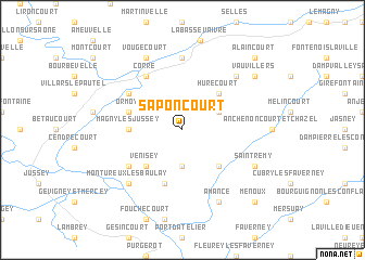
Saponcourt (Franche-Comté, France)Saponcourt is a town in the Franche-Comté region of France. An overview map of the region around Saponcourt is displayed below.
regional and 3d topo map of Saponcourt, France ::
Saponcourt airports ::
The nearest airport is EPL - Epinal Mirecourt, located 51.0 km north of Saponcourt.
Other airports nearby include ENC - Nancy Essey (92.9 km north), DIJ - Dijon Longvic (97.2 km south west), CMR - Colmar Houssen (102.6 km east), DLE - Dole Tavaux (102.7 km south west), Nearby towns ::
Contréglise (3.7km south) //
Polaincourt-et-Clairefontaine (3.1km north east) //
Hurecourt (4.5km north east) //
Venisey (4.5km south west) //
Senoncourt (4.5km south east) //
Magny-lès-Jussey (3.7km west) //
Ormoy (4.2km north west) //
Buffignécourt (5.7km south) //
Ranzevelle (5.3km north west) //
Corre (6.1km north west) //
Tartécourt (5.3km south west) //
Demangevelle (7.4km north) //
Montdoré (6.7km north east) //
Montureux-lès-Baulay (6.7km south west) //
Vougécourt (7.8km north) //
Saint-Rémy (6.2km south east) //
Amance (7.8km south) //
Vauvillers (7.5km north east) //
Alaincourt (8.9km north east) //
Menoux (8.9km south east) //
[all distances 'as the bird flies' and approximate] 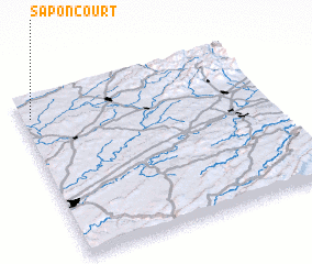 Places with similar names to Saponcourt, France ::
// Sepang Road (MY)
// Spincourt (FR)
Disclaimer :: Information on this page comes without warranty of any kind |
||
|
Where is Saponcourt? Elevation and coordinates ::
Latitude (lat): 47°52'0"N Longitude (lon): 6°2'0"E
Elevation (approx.): 313m (map arrows pan, magnifying glasses zoom) |
||
|
Visiting Saponcourt? Hotel/Accommodation ::
Book a hotel in Saponcourt Travel Guide ::
Buy a travel guide for France rental cars ::
car rental offers GPS waypoint ::
download a GPX waypoint (PoI) of Saponcourt for your GPS receiver
|
||