|
search place name
|
||
Servollette (Centre, France)Servollette is a town in the Centre region of France. An overview map of the region around Servollette is displayed below.
regional and 3d topo map of Servollette, France ::

Servollette airports ::
The nearest airport is CHR - Chateauroux Deols, located 43.8 km east of Servollette.
Other airports nearby include TUF - Tours Val De Loire (60.7 km north west), PIS - Poitiers Biard (80.1 km south west), BOU - Bourges (90.6 km east), ORE - Orleans Bricy (119.8 km north), Nearby towns ::
Châtillon-sur-Indre (1.3km west) //
Le Portau (2.5km east) //
La Motte Blanche (3.9km north) //
Semblançay (4.5km south east) //
La Côte (5.7km south) //
Le Tranger (5.3km south east) //
Vitray (6.1km north west) //
Saint-Cyran-du-Jambot (5.3km north west) //
La Bataillerie (5.4km west) //
Saint-Médard (5.4km east) //
Clion (6.7km south east) //
Villedômain (9.0km north east) //
[all distances 'as the bird flies' and approximate] 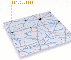 Places with similar names to Servollette, France ::
// Sauerfeld (AT)
// Syrafeld (AT)
// Serrfeld (DE)
// Syreflot (NO)
// Sőreföld (HU)
// Servilleta (US)
// Sarvelāt (IR)
// Sarvilahti (FI)
// Sarvilahti (FI)
// Surfleet (GB)
Disclaimer :: Information on this page comes without warranty of any kind |
||
|
Where is Servollette? Elevation and coordinates ::
Latitude (lat): 46°59'0"N Longitude (lon): 1°11'0"E
Elevation (approx.): 89m (map arrows pan, magnifying glasses zoom) |
||
|
Visiting Servollette? Hotel/Accommodation ::
Book a hotel in Servollette Travel Guide ::
Buy a travel guide for France rental cars ::
car rental offers GPS waypoint ::
download a GPX waypoint (PoI) of Servollette for your GPS receiver
|
||