|
search place name
|
||
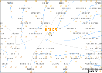
Uglas (Midi-Pyrénées, France)Uglas is a town in the Midi-Pyrénées region of France. An overview map of the region around Uglas is displayed below.
regional and 3d topo map of Uglas, France ::
Uglas airports ::
The nearest airport is LDE - Tarbes Lourdes, located 36.1 km west of Uglas.
Other airports nearby include PUF - Pau Pyrenees (74.4 km west), LRH - La Rochelle Lherm (75.9 km north east), TLS - Toulouse Blagnac (93.4 km north east), AGF - Agen La Garenne (116.4 km north), Nearby towns ::
Pinas (1.9km south) //
Réjaumont (2.3km north east) //
Clarens (3.9km north) //
Tuzaguet (5.6km south) //
Lannemezan (4.1km west) //
Campistrous (4.5km north west) //
Escala (6.2km south west) //
Galez (6.2km north west) //
Tajan (6.2km north east) //
Bizous (7.4km south) //
Montoussé (7.5km south) //
Lécussan (5.7km east) //
La Barthe-de-Neste (6.9km south west) //
Saint-Laurent-de-Neste (6.9km south east) //
Monlong (7.9km north) //
Izaux (8.5km south west) //
Anères (8.5km south east) //
Bonrepos (8.4km north west) //
Nestier (9.2km south east) //
[all distances 'as the bird flies' and approximate] 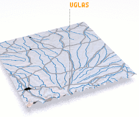 Places with similar names to Uglas, France ::
Disclaimer :: Information on this page comes without warranty of any kind |
||
|
Where is Uglas? Elevation and coordinates ::
Latitude (lat): 43°8'0"N Longitude (lon): 0°26'0"W
Elevation (approx.): 551m (map arrows pan, magnifying glasses zoom) |
||
|
Visiting Uglas? Hotel/Accommodation ::
Book a hotel in Uglas Travel Guide ::
Buy a travel guide for France rental cars ::
car rental offers GPS waypoint ::
download a GPX waypoint (PoI) of Uglas for your GPS receiver
|
||