|
search place name
|
||
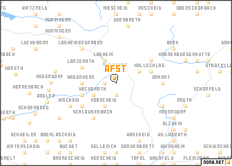
Afst (Liège, Belgium)Afst is a town in the Liège region of Belgium. An overview map of the region around Afst is displayed below.
regional and 3d topo map of Afst, Belgium ::
Afst airports ::
The nearest airport is SPM - Spangdahlem Ab, located 45.8 km south east of Afst.
Other airports nearby include ZQF - Trier Fohren (59.8 km south east), GKE - Geilenkirchen (73.8 km north), LGG - Liege (74.8 km north west), HHN - Frankfurt Hahn (76.1 km south east), Nearby towns ::
Krewinkel (1.2km west) //
Roth (1.9km south) //
Berterath (1.2km west) //
Allmuten (1.9km north) //
Weckerath (3.0km south west) //
Kobscheid (3.9km south) //
Losheim (3.9km north) //
Scheid (3.0km north east) //
Hasenvenn (3.5km west) //
Manderfeld (3.5km west) //
Verschneid (4.0km south west) //
Hallschlag (4.0km north east) //
Lanzerath (4.4km north west) //
Schlausenbach (6.0km south west) //
Auw (5.1km south west) //
Frauenkron (5.1km north east) //
Ormont (4.7km east) //
Losheimergraben (6.6km north west) //
Wischeid (6.0km south west) //
Neuenstein (6.0km south east) //
[all distances 'as the bird flies' and approximate]  Places with similar names to Afst, Belgium ::
Disclaimer :: Information on this page comes without warranty of any kind |
||
|
Where is Afst? Elevation and coordinates ::
Latitude (lat): 50°20'0"N Longitude (lon): 6°23'0"E
Elevation (approx.): 554m (map arrows pan, magnifying glasses zoom) |
||
|
Visiting Afst? Hotel/Accommodation ::
Book a hotel in Afst Travel Guide ::
Buy a travel guide for Belgium rental cars ::
car rental offers GPS waypoint ::
download a GPX waypoint (PoI) of Afst for your GPS receiver
|
||