|
search place name
|
||
De Draaiboom (Antwerpen, Belgium)De Draaiboom is a town in the Antwerpen region of Belgium. An overview map of the region around De Draaiboom is displayed below.
regional and 3d topo map of De Draaiboom, Belgium ::

De Draaiboom airports ::
The nearest airport is ANR - Antwerp Deurne, located 15.9 km west of De Draaiboom.
Other airports nearby include WOE - Woensdrecht (35.1 km north west), BRU - Brussels Natl (Melsbroek) (37.7 km south), EIN - Eindhoven (54.7 km north east), MST - Maastricht (83.4 km south east), Nearby towns ::
Pulderbos (0.0km north) //
Heuvelheide (1.2km west) //
Hooidonk (1.9km north) //
Heikant (2.2km north west) //
Waterschap (2.2km south west) //
Menekhoeven (2.2km south west) //
Heiblok (2.2km north east) //
Vroegeinde (2.2km south east) //
Pulle (2.2km south east) //
Zandhoven (2.3km west) //
Driehoek (2.3km east) //
Pitinks (3.9km north) //
Molenheide (3.0km south west) //
Vierseldijk (3.0km south west) //
Nederviersel (3.9km south) //
Kleineheide (3.0km north east) //
Grote Heide (3.0km north east) //
Molenheide (3.0km north east) //
Paddekoten (3.9km south) //
Grobbendonk (3.0km south east) //
Strateneinde (4.4km south west) //
Vierselsebergen (4.4km south west) //
Einhoven (4.4km north east) //
Groot Eisterle (4.4km south east) //
Dorsel (5.6km south) //
Moleneinde (3.5km west) //
Krabbels (3.5km east) //
Lovenhoek (3.5km east) //
Boshoven (3.5km east) //
[all distances 'as the bird flies' and approximate] 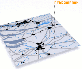 Places with similar names to De Draaiboom, Belgium :: Disclaimer :: Information on this page comes without warranty of any kind |
||
|
Where is De Draaiboom? Elevation and coordinates ::
Latitude (lat): 51°13'0"N Longitude (lon): 4°41'0"E
Elevation (approx.): 8m (map arrows pan, magnifying glasses zoom) |
||
|
Visiting De Draaiboom? Hotel/Accommodation ::
Book a hotel in De Draaiboom Travel Guide ::
Buy a travel guide for Belgium rental cars ::
car rental offers GPS waypoint ::
download a GPX waypoint (PoI) of De Draaiboom for your GPS receiver
|
||