|
search place name
|
||
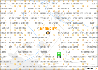
Den Dries (Brabant, Belgium)Den Dries is a town in the Brabant region of Belgium. An overview map of the region around Den Dries is displayed below.
regional and 3d topo map of Den Dries, Belgium ::
nearby GPS traces from timatio ::
Den Dries airports ::
The nearest airport is BRU - Brussels Natl (Melsbroek), located 7.7 km south of Den Dries.
Other airports nearby include ANR - Antwerp Deurne (24.8 km north), WOE - Woensdrecht (54.2 km north), CRL - Charleroi Brussels South (56.5 km south), LGG - Liege (79.0 km south east), Nearby towns ::
Kleempoel (1.9km north) //
Kleinelinde (1.9km north) //
Rijkenhoek (1.2km west) //
Eppegem (1.2km east) //
Weerdenhoek (2.2km north east) //
Zemst (2.2km north east) //
Bos (2.2km north west) //
Houtem (2.2km south east) //
Mot (2.2km south west) //
Steenmolenbrug (2.3km east) //
Kerselaren Dries (2.3km west) //
Weerde (2.3km east) //
Den Berg (2.3km east) //
Peutie (3.7km south) //
Spilt (3.0km north west) //
De Brug (3.0km north east) //
Verbrande Brug (3.0km south west) //
Dries (3.9km north) //
Halfgalg (3.9km north) //
Vilvoorde (3.9km south) //
Pikkerij (4.4km north west) //
Laar (4.4km north west) //
Geerdegemveld (4.4km north east) //
Huinhoven (4.4km south east) //
Wippendries (3.5km east) //
Elewijt (3.5km east) //
Hombeek (5.6km north) //
Het Sas (4.0km north west) //
Den Berg (4.0km north west) //
[all distances 'as the bird flies' and approximate] 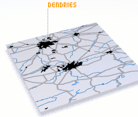 Places with similar names to Den Dries, Belgium ::
// Ðondraši (BA)
// Din Tarsa (RO)
// Tintores (ES)
// Denny Terrace (US)
// Dindérésso (BF)
// Tenedores (GT)
// Tandurusa (ID)
// Tanatarci (MK)
// Tendruasi (GH)
// Tendurasi (GH)
Disclaimer :: Information on this page comes without warranty of any kind |
||
|
Where is Den Dries? Elevation and coordinates ::
Latitude (lat): 50°58'0"N Longitude (lon): 4°27'0"E
Elevation (approx.): 8m (map arrows pan, magnifying glasses zoom) |
||
|
Visiting Den Dries? Hotel/Accommodation ::
Book a hotel in Den Dries Travel Guide ::
Buy a travel guide for Belgium rental cars ::
car rental offers GPS waypoint ::
download a GPX waypoint (PoI) of Den Dries for your GPS receiver
|
||