|
search place name
|
||
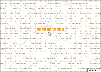
Erembodegem (Oost-Vlaanderen, Belgium)Erembodegem is a town in the Oost-Vlaanderen region of Belgium. An overview map of the region around Erembodegem is displayed below.
regional and 3d topo map of Erembodegem, Belgium ::
Erembodegem airports ::
The nearest airport is BRU - Brussels Natl (Melsbroek), located 30.6 km east of Erembodegem.
Other airports nearby include ANR - Antwerp Deurne (41.8 km north east), CRL - Charleroi Brussels South (58.3 km south east), QKT - Kortrijk-vevelgem Wevelgem (60.5 km west), WOE - Woensdrecht (62.7 km north), Nearby towns ::
Leuvenstraat (1.2km east) //
Grotendries (1.9km south) //
Kleinedries (1.9km south) //
Sint-Job (2.2km north west) //
Aalst (2.2km north west) //
Ronseval (2.2km north east) //
Broek (2.2km south west) //
Welle (2.2km south west) //
Ressebeek (2.2km south east) //
Kapelle Meersen (2.2km south east) //
Terjoden (2.2km south west) //
Brusselbaan (2.3km east) //
Kleistraat (2.3km east) //
Pijpenbeek (2.3km west) //
Restert (2.3km west) //
Hoek (2.3km east) //
Groenstraat (2.3km east) //
Dries (2.3km west) //
Paperode (3.7km north) //
Wildebeek (3.7km south) //
Siesegem (3.0km north west) //
Mijlbeek (3.0km north east) //
Zurendries (3.0km north west) //
Dries (3.0km south west) //
Kerrebroek (3.9km north) //
Malegem (3.9km south) //
Leeuwbrug (3.9km south) //
Denderleeuw (3.9km south) //
Anderenbroek (3.9km south) //
[all distances 'as the bird flies' and approximate]  Places with similar names to Erembodegem, Belgium :: Disclaimer :: Information on this page comes without warranty of any kind |
||
|
Where is Erembodegem? Elevation and coordinates ::
Latitude (lat): 50°55'0"N Longitude (lon): 4°3'0"E
Elevation (approx.): 18m (map arrows pan, magnifying glasses zoom) |
||
|
Visiting Erembodegem? Hotel/Accommodation ::
Book a hotel in Erembodegem Travel Guide ::
Buy a travel guide for Belgium rental cars ::
car rental offers GPS waypoint ::
download a GPX waypoint (PoI) of Erembodegem for your GPS receiver
|
||