|
search place name
|
||
Het Zwin (West-Vlaanderen, Belgium)Het Zwin is a town in the West-Vlaanderen region of Belgium. An overview map of the region around Het Zwin is displayed below.
regional and 3d topo map of Het Zwin, Belgium ::

Het Zwin airports ::
The nearest airport is OST - Oostende, located 39.8 km south west of Het Zwin.
Other airports nearby include QKT - Kortrijk-vevelgem Wevelgem (62.2 km south), WOE - Woensdrecht (68.5 km east), ANR - Antwerp Deurne (78.8 km east), LIL - Lille Lesquin (91.6 km south), Nearby towns ::
Retranchement (2.2km south east) //
Cadzand-Bad (3.0km north east) //
Zevecote (3.0km south west) //
Hazegras (3.9km south) //
De Vrede (3.9km south) //
Terhofstede (4.4km south east) //
De Brabander (4.4km south west) //
Cadzand (3.5km east) //
Sint Anna ter Muiden (5.6km south) //
Sluis (5.7km south) //
De Nachtegaal (5.7km south) //
De Meunink (5.1km south west) //
Schapenbrug (6.0km south west) //
Blauwe Sluis (7.4km south) //
Groenplein (5.0km west) //
Het Zoute (5.0km west) //
Slikkenburg (5.9km south east) //
Driewege (5.9km south west) //
Westkapelle (7.2km south west) //
Draaibrug (8.7km south east) //
[all distances 'as the bird flies' and approximate] 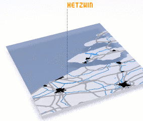 Places with similar names to Het Zwin, Belgium ::
// White Swan (US)
Disclaimer :: Information on this page comes without warranty of any kind |
||
|
Where is Het Zwin? Elevation and coordinates ::
Latitude (lat): 51°22'0"N Longitude (lon): 3°22'0"E
Elevation (approx.): -32768m (map arrows pan, magnifying glasses zoom) |
||
|
Visiting Het Zwin? Hotel/Accommodation ::
Book a hotel in Het Zwin Travel Guide ::
Buy a travel guide for Belgium rental cars ::
car rental offers GPS waypoint ::
download a GPX waypoint (PoI) of Het Zwin for your GPS receiver
|
||