|
search place name
|
||
La Houlette (Hainaut, Belgium)La Houlette is a town in the Hainaut region of Belgium. An overview map of the region around La Houlette is displayed below.
regional and 3d topo map of La Houlette, Belgium ::

La Houlette airports ::
The nearest airport is LIL - Lille Lesquin, located 50.2 km north west of La Houlette.
Other airports nearby include CRL - Charleroi Brussels South (57.0 km east), QKT - Kortrijk-vevelgem Wevelgem (65.2 km north west), BRU - Brussels Natl (Melsbroek) (86.3 km north east), ANR - Antwerp Deurne (111.5 km north east), Nearby towns ::
Bry (0.0km north) //
Eth (1.2km west) //
Roisin (1.9km north) //
Meaurain (2.2km north east) //
Wargnies-le-Petit (2.2km south west) //
Wargnies-le-Grand (2.4km west) //
Boughors (3.7km north) //
Angreau (3.7km north) //
Preux-au-Sart (3.7km south) //
La Flamengrie (2.4km east) //
La Flamengrie (2.4km east) //
Pré Bélène (3.0km north east) //
La Perche Rompue (3.0km south east) //
Sebourquiaux (4.4km north west) //
Sebourg (4.4km north west) //
Caillou qui Bique (4.4km north east) //
Autreppe (4.4km north east) //
Frasnoy (5.6km south) //
Angre (5.6km north) //
Onnezies (5.7km north) //
Passe Tout Outre (5.1km north east) //
Rombies-et-Marchipont (6.0km north west) //
Gommegnies (6.0km south east) //
Amfroipret (5.1km south east) //
Montignies-sur-Roc (6.0km north east) //
Baisieux (7.4km north) //
Jenlain (4.7km west) //
Bettrechies (4.7km east) //
Petit Baisieux (7.5km north) //
[all distances 'as the bird flies' and approximate] 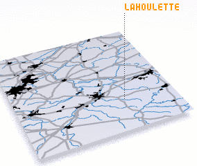 Places with similar names to La Houlette, Belgium ::
Disclaimer :: Information on this page comes without warranty of any kind |
||
|
Where is La Houlette? Elevation and coordinates ::
Latitude (lat): 50°19'0"N Longitude (lon): 3°41'0"E
Elevation (approx.): 102m (map arrows pan, magnifying glasses zoom) |
||
|
Visiting La Houlette? Hotel/Accommodation ::
Book a hotel in La Houlette Travel Guide ::
Buy a travel guide for Belgium rental cars ::
car rental offers GPS waypoint ::
download a GPX waypoint (PoI) of La Houlette for your GPS receiver
|
||