|
search place name
|
||
Malèves-Sainte-Marie-Wastines (Brabant, Belgium)Malèves-Sainte-Marie-Wastines is a town in the Brabant region of Belgium. An overview map of the region around Malèves-Sainte-Marie-Wastines is displayed below.
regional and 3d topo map of Malèves-Sainte-Marie-Wastines, Belgium ::

Malèves-Sainte-Marie-Wastines airports ::
The nearest airport is CRL - Charleroi Brussels South, located 31.6 km south west of Malèves-Sainte-Marie-Wastines.
Other airports nearby include BRU - Brussels Natl (Melsbroek) (35.0 km north west), LGG - Liege (46.7 km east), ANR - Antwerp Deurne (64.2 km north), MST - Maastricht (75.4 km north east), Nearby towns ::
Glatigny (1.2km east) //
Thorembais-Saint-Trond (1.9km south) //
Orbais (2.2km south west) //
Wastines (2.2km north east) //
Sainte-Marie (2.2km north east) //
Ponceau (3.9km south) //
Sart Risbart (3.9km north) //
Opprebais (3.9km north) //
Thorembais-les-Béguines (3.0km north east) //
Perwez (4.4km south east) //
Le Mont (4.4km south east) //
Les États (4.4km north east) //
Taravisée (5.6km south) //
Champ du Long Pré (3.5km east) //
Incourt (5.6km north) //
Respaille (5.7km south) //
Lerinnes (4.0km south west) //
Somville (4.0km north west) //
Thorembisoul (4.0km north east) //
Warichet (4.0km south east) //
Brombais (5.7km north) //
Jausselette (5.1km south east) //
Sart lez Walhain (5.1km south west) //
Les Cinq Étoiles (6.0km south west) //
Chaumont-Gistoux (5.1km north west) //
Glimes (5.1km north east) //
Arnelle (6.0km north west) //
Baraque (6.0km south east) //
Aische-en-Refail (6.0km south east) //
[all distances 'as the bird flies' and approximate] 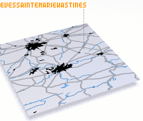 Places with similar names to Malèves-Sainte-Marie-Wastines, Belgium :: Disclaimer :: Information on this page comes without warranty of any kind |
||
|
Where is Malèves-Sainte-Marie-Wastines? Elevation and coordinates ::
Latitude (lat): 50°39'0"N Longitude (lon): 4°47'0"E
Elevation (approx.): 142m (map arrows pan, magnifying glasses zoom) |
||
|
Visiting Malèves-Sainte-Marie-Wastines? Hotel/Accommodation ::
Book a hotel in Malèves-Sainte-Marie-Wastines Travel Guide ::
Buy a travel guide for Belgium rental cars ::
car rental offers GPS waypoint ::
download a GPX waypoint (PoI) of Malèves-Sainte-Marie-Wastines for your GPS receiver
|
||