|
search place name
|
||
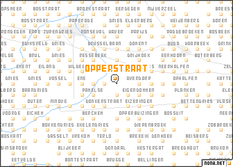
Opperstraat (Brabant, Belgium)Opperstraat is a town in the Brabant region of Belgium. An overview map of the region around Opperstraat is displayed below.
regional and 3d topo map of Opperstraat, Belgium ::
Opperstraat airports ::
The nearest airport is BRU - Brussels Natl (Melsbroek), located 27.3 km east of Opperstraat.
Other airports nearby include ANR - Antwerp Deurne (43.9 km north east), CRL - Charleroi Brussels South (51.8 km south east), QKT - Kortrijk-vevelgem Wevelgem (63.3 km west), WOE - Woensdrecht (67.0 km north), Nearby towns ::
Liedekerke (1.2km west) //
Vijfhoek (1.2km west) //
Pijnegem (1.2km west) //
Kattem (1.9km south) //
Kleemputten (2.2km north west) //
Klei (2.2km south east) //
Sint-Eucharis (2.2km south east) //
Rattendries (2.2km south east) //
Hekelgem (3.7km north) //
Teralfene (3.7km north) //
Huissegem (2.3km west) //
Evergem (2.3km west) //
Bakergem (2.3km west) //
Schepenijsel (2.3km east) //
Overdorp (2.3km east) //
Loddershoek (2.3km east) //
Essene Winkel (2.3km east) //
Leeuwbrug (3.0km north west) //
Malegem (3.0km north west) //
Lichtenhoek (3.0km north west) //
Denderleeuw (3.0km north west) //
Biezendries (3.0km north east) //
Hauwijk (3.0km north east) //
Impegem (3.0km south west) //
Meersen (3.0km south west) //
Pamelse (3.0km south west) //
Eigendommen (3.0km south east) //
Gucht (3.0km south east) //
Poulk (3.9km south) //
[all distances 'as the bird flies' and approximate]  Places with similar names to Opperstraat, Belgium :: Disclaimer :: Information on this page comes without warranty of any kind |
||
|
Where is Opperstraat? Elevation and coordinates ::
Latitude (lat): 50°52'0"N Longitude (lon): 4°6'0"E
Elevation (approx.): 25m (map arrows pan, magnifying glasses zoom) |
||
|
Visiting Opperstraat? Hotel/Accommodation ::
Book a hotel in Opperstraat Travel Guide ::
Buy a travel guide for Belgium rental cars ::
car rental offers GPS waypoint ::
download a GPX waypoint (PoI) of Opperstraat for your GPS receiver
|
||