|
search place name
|
||
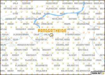
Pandgatheide (Antwerpen, Belgium)Pandgatheide is a town in the Antwerpen region of Belgium. An overview map of the region around Pandgatheide is displayed below.
regional and 3d topo map of Pandgatheide, Belgium ::
Pandgatheide airports ::
The nearest airport is ANR - Antwerp Deurne, located 22.2 km north east of Pandgatheide.
Other airports nearby include BRU - Brussels Natl (Melsbroek) (24.2 km south east), WOE - Woensdrecht (45.0 km north), CRL - Charleroi Brussels South (67.5 km south), QKT - Kortrijk-vevelgem Wevelgem (76.8 km west), Nearby towns ::
Smissen (0.0km north) //
Keten (0.0km north) //
Larendries (1.2km west) //
Valk (1.2km west) //
Heiken (1.2km west) //
Nieuwstad (1.9km south) //
Nijven (1.2km east) //
Wipheide (1.2km east) //
Katte Straat (1.9km north) //
Opdorp (2.2km south west) //
ʼt Hoogste (2.2km north west) //
Breutheide (2.2km south east) //
Drie Huizen (2.2km south east) //
Kruisheide (2.2km south east) //
Groot Schaddeken Dries (2.2km north east) //
Meir (2.2km north east) //
Oppuurs (2.2km north east) //
Boksheide (3.7km south) //
Mattestraat (3.7km south) //
Sint-Amands (2.3km west) //
Klemheide (3.7km north) //
Bree Ven (3.7km north) //
Boskant (3.7km north) //
Lippelo (2.3km east) //
De Heide (2.3km east) //
Achterheide (2.3km east) //
Zavelberg (3.9km north) //
Hoge Heide (3.9km north) //
Grote Heide (3.9km north) //
[all distances 'as the bird flies' and approximate] 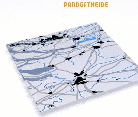 Places with similar names to Pandgatheide, Belgium :: Disclaimer :: Information on this page comes without warranty of any kind |
||
|
Where is Pandgatheide? Elevation and coordinates ::
Latitude (lat): 51°3'0"N Longitude (lon): 4°14'0"E
Elevation (approx.): 2m (map arrows pan, magnifying glasses zoom) |
||
|
Visiting Pandgatheide? Hotel/Accommodation ::
Book a hotel in Pandgatheide Travel Guide ::
Buy a travel guide for Belgium rental cars ::
car rental offers GPS waypoint ::
download a GPX waypoint (PoI) of Pandgatheide for your GPS receiver
|
||