|
search place name
|
||
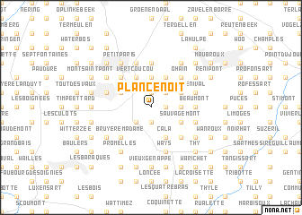
Plancenoit (Brabant, Belgium)Plancenoit is a town in the Brabant region of Belgium. An overview map of the region around Plancenoit is displayed below.
regional and 3d topo map of Plancenoit, Belgium ::
Plancenoit airports ::
The nearest airport is CRL - Charleroi Brussels South, located 23.1 km south of Plancenoit.
Other airports nearby include BRU - Brussels Natl (Melsbroek) (26.4 km north), ANR - Antwerp Deurne (58.2 km north), LGG - Liege (71.5 km east), WOE - Woensdrecht (87.3 km north), Nearby towns ::
La Marache (1.9km north) //
Maransart (1.2km east) //
Payot (1.2km east) //
Les Flamandes (1.9km south) //
Hanogrune (1.9km south) //
Beau Chêne (2.2km north east) //
Smohain (2.2km north east) //
Cheval de Bois (2.2km north east) //
Vieux Manant (2.2km south west) //
Maison du Roi (2.2km south west) //
Haut Ransbeek (3.7km north) //
Couture-Saint-Germain (2.3km east) //
Mont Saint-Jean (3.0km north west) //
Roussart (3.9km north) //
Les Baraques (3.9km north) //
Vert Coucou (3.9km north) //
Bas Ransbeek (3.9km north) //
Basse Lasne (3.0km north east) //
Genleau (3.0km north east) //
Aquinot (3.0km north east) //
Sauvagemont (3.0km south east) //
Colinet (3.0km south east) //
Glabais (3.9km south) //
Cala (3.9km south) //
Six Maisons (4.4km north west) //
Joli Bois (4.4km north west) //
Fond Vandenbosch (4.4km north west) //
Ohain (4.4km north east) //
Audrimont (4.4km north east) //
[all distances 'as the bird flies' and approximate] 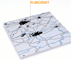 Places with similar names to Plancenoit, Belgium :: Disclaimer :: Information on this page comes without warranty of any kind |
||
|
Where is Plancenoit? Elevation and coordinates ::
Latitude (lat): 50°40'0"N Longitude (lon): 4°26'0"E
Elevation (approx.): 124m (map arrows pan, magnifying glasses zoom) |
||
|
Visiting Plancenoit? Hotel/Accommodation ::
Book a hotel in Plancenoit Travel Guide ::
Buy a travel guide for Belgium rental cars ::
car rental offers GPS waypoint ::
download a GPX waypoint (PoI) of Plancenoit for your GPS receiver
|
||