|
search place name
|
||
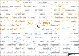
Stenenstraat (Antwerpen, Belgium)Stenenstraat is a town in the Antwerpen region of Belgium. An overview map of the region around Stenenstraat is displayed below.
regional and 3d topo map of Stenenstraat, Belgium ::
Stenenstraat airports ::
The nearest airport is ANR - Antwerp Deurne, located 33.2 km west of Stenenstraat.
Other airports nearby include EIN - Eindhoven (40.3 km north east), BRU - Brussels Natl (Melsbroek) (47.1 km south west), WOE - Woensdrecht (48.7 km north west), MST - Maastricht (67.8 km south east), Nearby towns ::
Hukkelberg (1.2km west) //
Seggen (1.9km south) //
Het Varenbroek (1.2km east) //
Goor (1.2km east) //
Molenstraat (2.2km north west) //
Weidonk (2.2km south west) //
Eerselingen (2.2km south west) //
Klein Goor (2.2km north east) //
Hogen Rielen (3.7km north) //
Lagen Rielen (3.7km north) //
Hoebenschot (3.0km north west) //
Lichtaart (3.0km north west) //
Kasterlee (3.9km north) //
Larumseheide (3.9km south) //
Ossen Goor (3.0km north east) //
Hoge Bergen (3.0km north east) //
Rundsvoort (3.0km south east) //
Gooreind (3.0km south east) //
Den Molenberg (4.4km north west) //
Pleintje (4.4km north west) //
Opstal (4.4km north west) //
Sint-Jozef-Olen (4.4km south west) //
Nederheide (4.4km south west) //
Groot Goor (4.4km north east) //
Velveken (5.6km south) //
Buitenste Einde (5.6km south) //
Binneneinde (5.6km south) //
Balderij (5.6km north) //
Oosteinde (3.9km north east) //
[all distances 'as the bird flies' and approximate]  Places with similar names to Stenenstraat, Belgium :: Disclaimer :: Information on this page comes without warranty of any kind |
||
|
Where is Stenenstraat? Elevation and coordinates ::
Latitude (lat): 51°13'0"N Longitude (lon): 4°56'0"E
Elevation (approx.): 14m (map arrows pan, magnifying glasses zoom) |
||
|
Visiting Stenenstraat? Hotel/Accommodation ::
Book a hotel in Stenenstraat Travel Guide ::
Buy a travel guide for Belgium rental cars ::
car rental offers GPS waypoint ::
download a GPX waypoint (PoI) of Stenenstraat for your GPS receiver
|
||