|
search place name
|
||
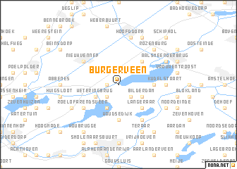
Burgerveen (Noord-Holland, Netherlands)Burgerveen is a town in the Noord-Holland region of Netherlands. An overview map of the region around Burgerveen is displayed below.
regional and 3d topo map of Burgerveen, Netherlands ::
nearby GPS traces from timatio ::
Burgerveen airports ::
The nearest airport is AMS - Amsterdam Schiphol, located 10.0 km north east of Burgerveen.
Other airports nearby include LID - Valkenburg (19.6 km west), RTM - Rotterdam (35.1 km south west), UTC - Soesterberg (42.2 km east), DHR - De Kooy (77.1 km north), Nearby towns ::
Leimuiderbrug (1.1km west) //
Leimuiden (2.2km south west) //
Vriezekoop (2.2km south east) //
Rijnsaterwoude (3.9km south) //
Weteringbrug (2.9km south west) //
Oude Wetering (2.9km south west) //
ʼt Kabel (2.9km north west) //
Bilderdam (2.9km south east) //
Langeraar (4.3km south east) //
Rijsenhout (4.3km north east) //
Woudse Dijk (5.6km south) //
Kalslagen (3.4km east) //
Roelofarendsveen (5.0km south west) //
Papenveer (6.0km south) //
Nieuw-Vennep (5.0km north west) //
Kudelstaart (4.5km east) //
Hoofddorp (7.5km north) //
Rozenburg (6.5km north east) //
Nieuwe Wetering (5.9km south west) //
Ter Aar (7.8km south) //
Nieuwveen (5.9km south east) //
De Hoek (7.8km north) //
Aalsmeerderbrug (5.9km north east) //
Korteraar (8.2km south east) //
Woubrugge (8.2km south west) //
Schiphol (8.7km north east) //
[all distances 'as the bird flies' and approximate] 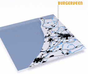 Places with similar names to Burgerveen, Netherlands ::
// Bargerfehn (DE)
// Bergerven (BE)
Disclaimer :: Information on this page comes without warranty of any kind |
||
|
Where is Burgerveen? Elevation and coordinates ::
Latitude (lat): 52°14'0"N Longitude (lon): 4°41'0"E
Elevation (approx.): -3m (map arrows pan, magnifying glasses zoom) |
||
|
Visiting Burgerveen? Hotel/Accommodation ::
Book a hotel in Burgerveen Travel Guide ::
Buy a travel guide for Netherlands rental cars ::
car rental offers GPS waypoint ::
download a GPX waypoint (PoI) of Burgerveen for your GPS receiver
|
||