|
search place name
|
||
Denekamp (Overijssel, Netherlands)Denekamp is a town in the Overijssel region of Netherlands. An overview map of the region around Denekamp is displayed below.
regional and 3d topo map of Denekamp, Netherlands ::

Denekamp airports ::
The nearest airport is ENS - Enschede Twenthe, located 15.3 km south west of Denekamp.
Other airports nearby include FMO - Muenster/osnabrueck Munster Osnabruck (54.3 km south east), GRQ - Groningen Eelde (86.7 km north), GUT - Guetersloh Gutersloh (103.0 km south east), DTM - Dortmund (105.0 km south east), Nearby towns ::
Mekkelhorst (2.2km south east) //
Berghum (2.2km south east) //
Noord-Deurningen (2.2km north east) //
Beuningen (3.7km south) //
Volthe (3.9km south west) //
Tilligte (3.9km north west) //
Frensdorferhaar (3.9km north east) //
Lattrop (5.7km north) //
Am Birkenvenn (4.5km east) //
De Lutte (7.5km south) //
Breklenkamp (7.5km north) //
De Poppe (7.8km south) //
Rossum (5.9km south west) //
Frenswegen (7.8km north) //
Blanke (5.8km north east) //
Holt (7.2km south east) //
Frensdorf (7.2km north east) //
Brecklenkamp (8.2km north west) //
Bußmaate (8.7km north east) //
[all distances 'as the bird flies' and approximate] 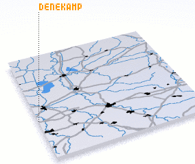
Disclaimer :: Information on this page comes without warranty of any kind |
||
|
Where is Denekamp? Elevation and coordinates ::
Latitude (lat): 52°23'0"N Longitude (lon): 7°0'0"E
Elevation (approx.): 25m (map arrows pan, magnifying glasses zoom) |
||
|
Visiting Denekamp? Hotel/Accommodation ::
Book a hotel in Denekamp Travel Guide ::
Buy a travel guide for Netherlands rental cars ::
car rental offers GPS waypoint ::
download a GPX waypoint (PoI) of Denekamp for your GPS receiver
|
||