|
search place name
|
||
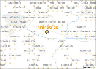
Den Opslag (Noord-Brabant, Netherlands)Den Opslag is a town in the Noord-Brabant region of Netherlands. An overview map of the region around Den Opslag is displayed below.
regional and 3d topo map of Den Opslag, Netherlands ::
Den Opslag airports ::
The nearest airport is EIN - Eindhoven, located 14.2 km south east of Den Opslag.
Other airports nearby include WOE - Woensdrecht (60.1 km west), ANR - Antwerp Deurne (63.1 km south west), UTC - Soesterberg (68.1 km north), RTM - Rotterdam (71.9 km north west), Nearby towns ::
Hild (1.9km north) //
Broekzijde (1.2km west) //
Lage Haghorst (1.9km south) //
Zelt (2.2km north west) //
Vinkenberg (2.2km north west) //
Haghorst (2.2km south east) //
Hooge Haghorst (2.2km south east) //
Heiligeboom (3.7km north) //
Heuvelstraat (2.3km west) //
Heikant (3.9km north) //
Moergestel (3.9km north) //
Stokske (3.9km north) //
Biest (3.5km west) //
Kattenberg (3.5km east) //
Hondsberg (5.7km north) //
Gemullehoeken (5.7km north) //
Kleine Voort (3.9km south west) //
Houtakker (3.9km south west) //
Baarschot (5.7km south) //
Diessen (5.7km south) //
De Logt (5.1km north east) //
Huygevoort (6.0km south east) //
Westerwijk (6.0km south west) //
Waterstraat (6.0km south west) //
De Baest (5.1km south east) //
Voorteind (5.1km south east) //
Beerten (5.1km south west) //
Oisterwijk (7.4km north) //
Westerwijk (4.6km west) //
[all distances 'as the bird flies' and approximate]  Places with similar names to Den Opslag, Netherlands :: Disclaimer :: Information on this page comes without warranty of any kind |
||
|
Where is Den Opslag? Elevation and coordinates ::
Latitude (lat): 51°31'0"N Longitude (lon): 5°12'0"E
Elevation (approx.): 10m (map arrows pan, magnifying glasses zoom) |
||
|
Visiting Den Opslag? Hotel/Accommodation ::
Book a hotel in Den Opslag Travel Guide ::
Buy a travel guide for Netherlands rental cars ::
car rental offers GPS waypoint ::
download a GPX waypoint (PoI) of Den Opslag for your GPS receiver
|
||