|
search place name
|
||
Ede (Gelderland, Netherlands)Ede is a town in the Gelderland region of Netherlands. An overview map of the region around Ede is displayed below.
regional and 3d topo map of Ede, Netherlands ::

Ede airports ::
The nearest airport is UTC - Soesterberg, located 28.7 km west of Ede.
Other airports nearby include EIN - Eindhoven (68.0 km south), AMS - Amsterdam Schiphol (68.9 km north west), RTM - Rotterdam (84.9 km west), ENS - Enschede Twenthe (86.7 km east), Nearby towns ::
Hoekelum (1.9km south) //
Veldhuizen (2.2km north west) //
Doesburgerbuurt (2.2km north west) //
Manen (2.3km west) //
Bennekom (3.9km south) //
Nergena (3.9km south) //
De Kraats (2.9km south west) //
Driesprong (4.4km north east) //
Kreel (3.9km north east) //
Wageningen-Hoog (6.0km south) //
Doesburg (5.0km north west) //
De Ginkel (4.6km east) //
Wageningen (7.4km south) //
Meulunteren (7.4km north) //
De Kade (4.9km west) //
Lunteren (6.5km north west) //
Nude (7.8km south) //
Renkum (8.7km south east) //
Roekel (8.7km north east) //
Achterberg (8.7km south west) //
Laareind (8.7km south west) //
[all distances 'as the bird flies' and approximate] 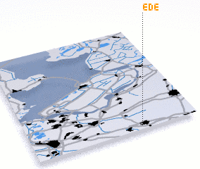 Places with similar names to Ede, Netherlands ::
Disclaimer :: Information on this page comes without warranty of any kind |
||
|
Where is Ede? Elevation and coordinates ::
Latitude (lat): 52°2'0"N Longitude (lon): 5°40'0"E
Elevation (approx.): 23m (map arrows pan, magnifying glasses zoom) |
||
|
Visiting Ede? Hotel/Accommodation ::
Book a hotel in Ede Travel Guide ::
Buy a travel guide for Netherlands rental cars ::
car rental offers GPS waypoint ::
download a GPX waypoint (PoI) of Ede for your GPS receiver
|
||