|
search place name
|
||
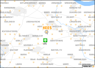
Hees (Utrecht, Netherlands)Hees is a town in the Utrecht region of Netherlands. An overview map of the region around Hees is displayed below.
regional and 3d topo map of Hees, Netherlands ::
Hees airports ::
The nearest airport is UTC - Soesterberg, located 2.6 km south of Hees.
Other airports nearby include AMS - Amsterdam Schiphol (39.6 km north west), LID - Valkenburg (59.3 km west), RTM - Rotterdam (61.9 km west), EIN - Eindhoven (78.1 km south), Nearby towns ::
Soestduinen (1.1km east) //
Eng (1.9km north) //
Wieksloot (2.2km north west) //
Soesterveen (2.2km north west) //
Ons Belang (2.2km south east) //
Soestdijk (3.7km north) //
Huis ter Heide (3.9km south) //
ʼt Hart (3.9km north) //
Pijnenburg (2.9km north west) //
Den Dolder (2.9km south west) //
Soest (3.9km north) //
Soest-Zuid (2.9km north east) //
Bosch en Duin (4.3km south west) //
Soesterberg (4.3km south east) //
Bunt (3.4km east) //
De Birk (3.9km north east) //
Lage-Vuursche (5.0km north west) //
Grote Melm (6.0km north) //
Baarn (7.4km north) //
Zeist (6.5km south west) //
Kerckebosch (7.8km south) //
Coelhorst (5.9km north east) //
Eembrugge (7.8km north) //
Austerlitz (7.8km south) //
De Kroost (7.2km south west) //
Nijenheim (8.7km south west) //
[all distances 'as the bird flies' and approximate]  Places with similar names to Hees, Netherlands ::
Disclaimer :: Information on this page comes without warranty of any kind |
||
|
Where is Hees? Elevation and coordinates ::
Latitude (lat): 52°9'0"N Longitude (lon): 5°17'0"E
Elevation (approx.): 9m (map arrows pan, magnifying glasses zoom) |
||
|
Visiting Hees? Hotel/Accommodation ::
Book a hotel in Hees Travel Guide ::
Buy a travel guide for Netherlands rental cars ::
car rental offers GPS waypoint ::
download a GPX waypoint (PoI) of Hees for your GPS receiver
|
||