|
search place name
|
||
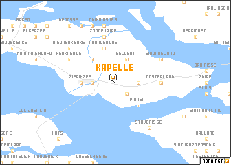
Kapelle (Zeeland, Netherlands)Kapelle is a town in the Zeeland region of Netherlands. An overview map of the region around Kapelle is displayed below.
regional and 3d topo map of Kapelle, Netherlands ::
Kapelle airports ::
The nearest airport is WOE - Woensdrecht, located 34.3 km south east of Kapelle.
Other airports nearby include RTM - Rotterdam (47.1 km north east), ANR - Antwerp Deurne (61.7 km south east), LID - Valkenburg (65.3 km north east), BRU - Brussels Natl (Melsbroek) (90.8 km south east), Nearby towns ::
Ouwerkerk (2.2km south east) //
Nieuwerkerk (2.3km east) //
Malta (2.3km west) //
Dreischor (3.9km north) //
Beldert (3.9km north) //
Vianen (4.4km south east) //
Schuddebeurs (4.4km north west) //
Zierikzee (3.4km west) //
Noordgouwe (5.7km north) //
Oosterland (4.6km east) //
Zonnemaire (7.5km north) //
Sirjansland (5.9km north east) //
Kerkwerve (5.9km north west) //
Stavenisse (8.2km south east) //
Nieuwerkerke (7.2km north west) //
[all distances 'as the bird flies' and approximate] 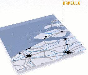 Places with similar names to Kapelle, Netherlands ::
Disclaimer :: Information on this page comes without warranty of any kind |
||
|
Where is Kapelle? Elevation and coordinates ::
Latitude (lat): 51°39'0"N Longitude (lon): 3°58'0"E
Elevation (approx.): -2m (map arrows pan, magnifying glasses zoom) |
||
|
Visiting Kapelle? Hotel/Accommodation ::
Book a hotel in Kapelle Travel Guide ::
Buy a travel guide for Netherlands rental cars ::
car rental offers GPS waypoint ::
download a GPX waypoint (PoI) of Kapelle for your GPS receiver
|
||