|
search place name
|
||
Luchtenveld (Friesland, Netherlands)Luchtenveld is a town in the Friesland region of Netherlands. An overview map of the region around Luchtenveld is displayed below.
regional and 3d topo map of Luchtenveld, Netherlands ::

Luchtenveld airports ::
The nearest airport is LWR - Leeuwarden, located 27.5 km west of Luchtenveld.
Other airports nearby include GRQ - Groningen Eelde (28.9 km east), BMK - Borkum (62.0 km north east), EME - Emden (76.7 km east), NRD - Norderney (94.8 km north east), Nearby towns ::
Houtigehage (1.1km west) //
Boelenslaan (1.9km north) //
Drachtstercompagnie (2.2km south west) //
Ureterp aan de Vaart (3.9km south) //
Pietersburen (3.9km south) //
Topweer (2.9km north east) //
Het Jachtveld (2.9km north west) //
Kortwoude (3.9km north) //
Surhuisterveen (3.9km north) //
Harkema-Opeinde (3.9km north) //
De Wieken (4.3km south west) //
Hamshorn (4.3km north west) //
Rottevalle (3.3km west) //
Roodeschuur (5.6km north) //
Ureterp (5.7km south) //
Selmien (5.7km south) //
Ureterperverlaat (5.7km south) //
Opende (3.8km north east) //
Opende-Zuid (3.8km north east) //
Witveen (3.8km north west) //
Buweklooster (5.7km north) //
Ophuis (5.7km north) //
Frieschepalen (5.0km south east) //
Trimunt (5.0km south east) //
Surhuizum (6.0km north) //
Drogeham (6.0km north) //
Rohel (7.4km north) //
Het Zwartveen (4.4km west) //
Augustinusga (7.5km north) //
[all distances 'as the bird flies' and approximate] 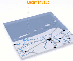 Places with similar names to Luchtenveld, Netherlands :: Disclaimer :: Information on this page comes without warranty of any kind |
||
|
Where is Luchtenveld? Elevation and coordinates ::
Latitude (lat): 53°9'0"N Longitude (lon): 6°9'0"E
(map arrows pan, magnifying glasses zoom) |
||
|
Visiting Luchtenveld? Hotel/Accommodation ::
Book a hotel in Luchtenveld Travel Guide ::
Buy a travel guide for Netherlands rental cars ::
car rental offers GPS waypoint ::
download a GPX waypoint (PoI) of Luchtenveld for your GPS receiver
|
||